You are here: Home > Network List > TA - USArray Transportable Network (new EarthScope stations) Stations List
> Station P26A Davis Ranch, Arriba, CO, USA > Earthquake Result Viewer
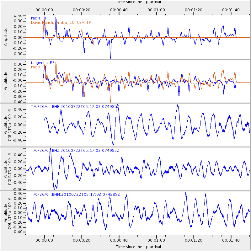
P26A Davis Ranch, Arriba, CO, USA - Earthquake Result Viewer
*The percent match for this event was below the threshold and hence no stack was calculated.
| Earthquake location: |
Vanuatu Islands |
| Earthquake latitude/longitude: |
-15.1/168.2 |
| Earthquake time(UTC): |
2010/07/22 (203) 05:03:57 GMT |
| Earthquake Depth: |
10 km |
| Earthquake Magnitude: |
6.2 MB, 5.4 MS, 6.1 MW, 5.9 MW |
| Earthquake Catalog/Contributor: |
WHDF/NEIC |
|
| Network: |
TA USArray Transportable Network (new EarthScope stations) |
| Station: |
P26A Davis Ranch, Arriba, CO, USA |
| Lat/Lon: |
39.56 N/103.35 W |
| Elevation: |
1566 m |
|
| Distance: |
98.3 deg |
| Az: |
51.356 deg |
| Baz: |
257.334 deg |
| Ray Param: |
$rayparam |
*The percent match for this event was below the threshold and hence was not used in the summary stack. |
|
| Radial Match: |
59.23749 % |
| Radial Bump: |
275 |
| Transverse Match: |
50.224255 % |
| Transverse Bump: |
316 |
| SOD ConfigId: |
319893 |
| Insert Time: |
2011-01-05 09:36:18.902 +0000 |
| GWidth: |
2.5 |
| Max Bumps: |
400 |
| Tol: |
0.001 |
|
Signal To Noise
| Channel | StoN | STA | LTA |
| TA:P26A: :BHZ:20100722T05:17:03.074985Z | 3.3230507 | 2.4631547E-7 | 7.4123285E-8 |
| TA:P26A: :BHN:20100722T05:17:03.074985Z | 0.65675306 | 7.639846E-8 | 1.1632753E-7 |
| TA:P26A: :BHE:20100722T05:17:03.074985Z | 0.97105545 | 1.4915483E-7 | 1.5360074E-7 |
| Arrivals |
| Ps | |
| PpPs | |
| PsPs/PpSs | |


