You are here: Home > Network List > CI - Caltech Regional Seismic Network Stations List
> Station TIN Tinemaha, Big Pine, CA, USA > Earthquake Result Viewer
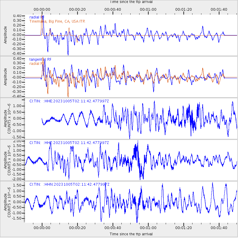
TIN Tinemaha, Big Pine, CA, USA - Earthquake Result Viewer
*The percent match for this event was below the threshold and hence no stack was calculated.
| Earthquake location: |
Southeast Of Honshu, Japan |
| Earthquake latitude/longitude: |
30.0/139.9 |
| Earthquake time(UTC): |
2023/10/05 (278) 01:59:58 GMT |
| Earthquake Depth: |
10 km |
| Earthquake Magnitude: |
6.1 mww |
| Earthquake Catalog/Contributor: |
NEIC PDE/us |
|
| Network: |
CI Caltech Regional Seismic Network |
| Station: |
TIN Tinemaha, Big Pine, CA, USA |
| Lat/Lon: |
37.05 N/118.23 W |
| Elevation: |
1197 m |
|
| Distance: |
81.0 deg |
| Az: |
52.441 deg |
| Baz: |
300.691 deg |
| Ray Param: |
$rayparam |
*The percent match for this event was below the threshold and hence was not used in the summary stack. |
|
| Radial Match: |
73.36157 % |
| Radial Bump: |
400 |
| Transverse Match: |
70.79852 % |
| Transverse Bump: |
400 |
| SOD ConfigId: |
31937991 |
| Insert Time: |
2023-10-19 02:14:09.744 +0000 |
| GWidth: |
2.5 |
| Max Bumps: |
400 |
| Tol: |
0.001 |
|
Signal To Noise
| Channel | StoN | STA | LTA |
| CI:TIN: :HHZ:20231005T02:11:42.477997Z | 4.3857975 | 7.2939093E-7 | 1.6630749E-7 |
| CI:TIN: :HHN:20231005T02:11:42.477997Z | 1.3303629 | 3.4314053E-7 | 2.5793003E-7 |
| CI:TIN: :HHE:20231005T02:11:42.477997Z | 1.194761 | 3.171542E-7 | 2.6545408E-7 |
| Arrivals |
| Ps | |
| PpPs | |
| PsPs/PpSs | |


