You are here: Home > Network List > UW - Pacific Northwest Regional Seismic Network Stations List
> Station FISH Seaside, OR, USA > Earthquake Result Viewer
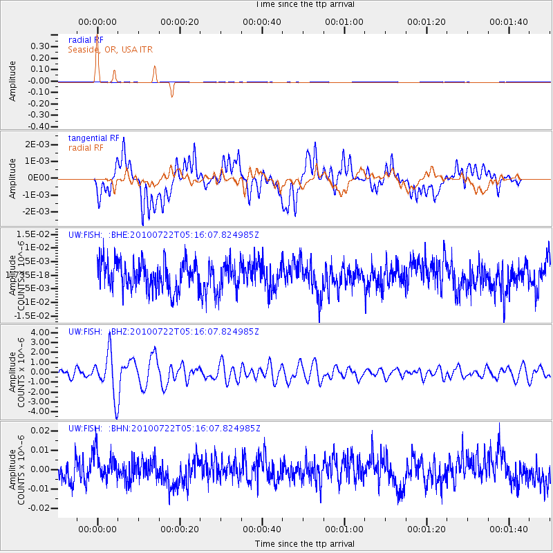
FISH Seaside, OR, USA - Earthquake Result Viewer
*The percent match for this event was below the threshold and hence no stack was calculated.
| Earthquake location: |
Vanuatu Islands |
| Earthquake latitude/longitude: |
-15.1/168.2 |
| Earthquake time(UTC): |
2010/07/22 (203) 05:03:57 GMT |
| Earthquake Depth: |
10 km |
| Earthquake Magnitude: |
6.2 MB, 5.4 MS, 6.1 MW, 5.9 MW |
| Earthquake Catalog/Contributor: |
WHDF/NEIC |
|
| Network: |
UW Pacific Northwest Regional Seismic Network |
| Station: |
FISH Seaside, OR, USA |
| Lat/Lon: |
45.93 N/123.56 W |
| Elevation: |
325 m |
|
| Distance: |
86.4 deg |
| Az: |
40.516 deg |
| Baz: |
244.014 deg |
| Ray Param: |
$rayparam |
*The percent match for this event was below the threshold and hence was not used in the summary stack. |
|
| Radial Match: |
42.57158 % |
| Radial Bump: |
400 |
| Transverse Match: |
45.081146 % |
| Transverse Bump: |
400 |
| SOD ConfigId: |
319893 |
| Insert Time: |
2011-01-05 09:45:27.202 +0000 |
| GWidth: |
2.5 |
| Max Bumps: |
400 |
| Tol: |
0.001 |
|
Signal To Noise
| Channel | StoN | STA | LTA |
| UW:FISH: :BHZ:20100722T05:16:07.824985Z | 6.9939513 | 2.2288732E-6 | 3.1868584E-7 |
| UW:FISH: :BHN:20100722T05:16:07.824985Z | 1.0834072 | 6.6643704E-9 | 6.151307E-9 |
| UW:FISH: :BHE:20100722T05:16:07.824985Z | 0.99351054 | 5.0262874E-9 | 5.0591185E-9 |
| Arrivals |
| Ps | |
| PpPs | |
| PsPs/PpSs | |


