You are here: Home > Network List > US - United States National Seismic Network Stations List
> Station AGMN Agassiz National Wildlife Refuge, Minnesota, USA > Earthquake Result Viewer
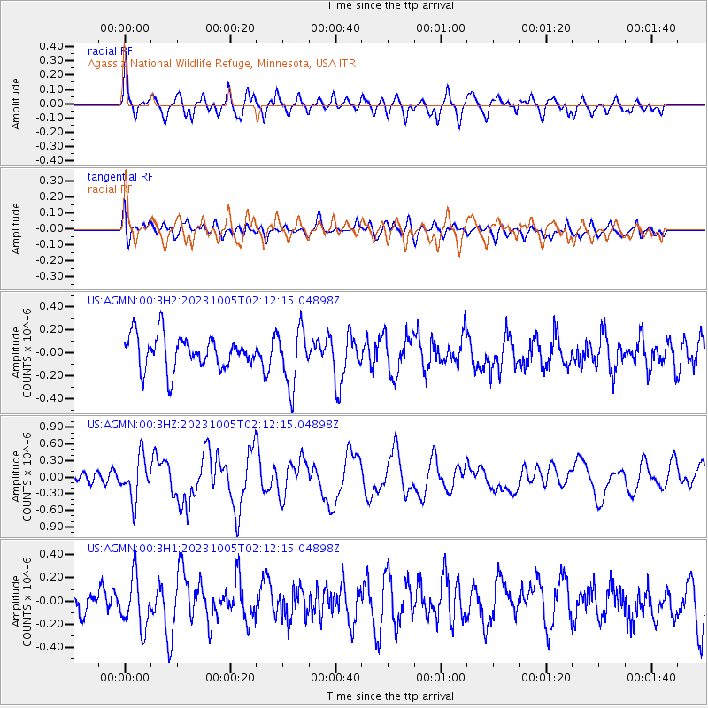
AGMN Agassiz National Wildlife Refuge, Minnesota, USA - Earthquake Result Viewer
*The percent match for this event was below the threshold and hence no stack was calculated.
| Earthquake location: |
Southeast Of Honshu, Japan |
| Earthquake latitude/longitude: |
30.0/139.9 |
| Earthquake time(UTC): |
2023/10/05 (278) 01:59:58 GMT |
| Earthquake Depth: |
10 km |
| Earthquake Magnitude: |
6.1 mww |
| Earthquake Catalog/Contributor: |
NEIC PDE/us |
|
| Network: |
US United States National Seismic Network |
| Station: |
AGMN Agassiz National Wildlife Refuge, Minnesota, USA |
| Lat/Lon: |
48.30 N/95.86 W |
| Elevation: |
351 m |
|
| Distance: |
87.5 deg |
| Az: |
33.565 deg |
| Baz: |
314.065 deg |
| Ray Param: |
$rayparam |
*The percent match for this event was below the threshold and hence was not used in the summary stack. |
|
| Radial Match: |
59.59927 % |
| Radial Bump: |
400 |
| Transverse Match: |
45.31444 % |
| Transverse Bump: |
400 |
| SOD ConfigId: |
31937991 |
| Insert Time: |
2023-10-19 02:31:43.128 +0000 |
| GWidth: |
2.5 |
| Max Bumps: |
400 |
| Tol: |
0.001 |
|
Signal To Noise
| Channel | StoN | STA | LTA |
| US:AGMN:00:BHZ:20231005T02:12:15.04898Z | 2.1393926 | 3.8938117E-7 | 1.8200548E-7 |
| US:AGMN:00:BH1:20231005T02:12:15.04898Z | 2.3420036 | 2.2495382E-7 | 9.605186E-8 |
| US:AGMN:00:BH2:20231005T02:12:15.04898Z | 1.7371093 | 2.4711656E-7 | 1.4225736E-7 |
| Arrivals |
| Ps | |
| PpPs | |
| PsPs/PpSs | |


