You are here: Home > Network List > UW - Pacific Northwest Regional Seismic Network Stations List
> Station HOOD Mt Hood Meadows, OR CREST BB SMO > Earthquake Result Viewer
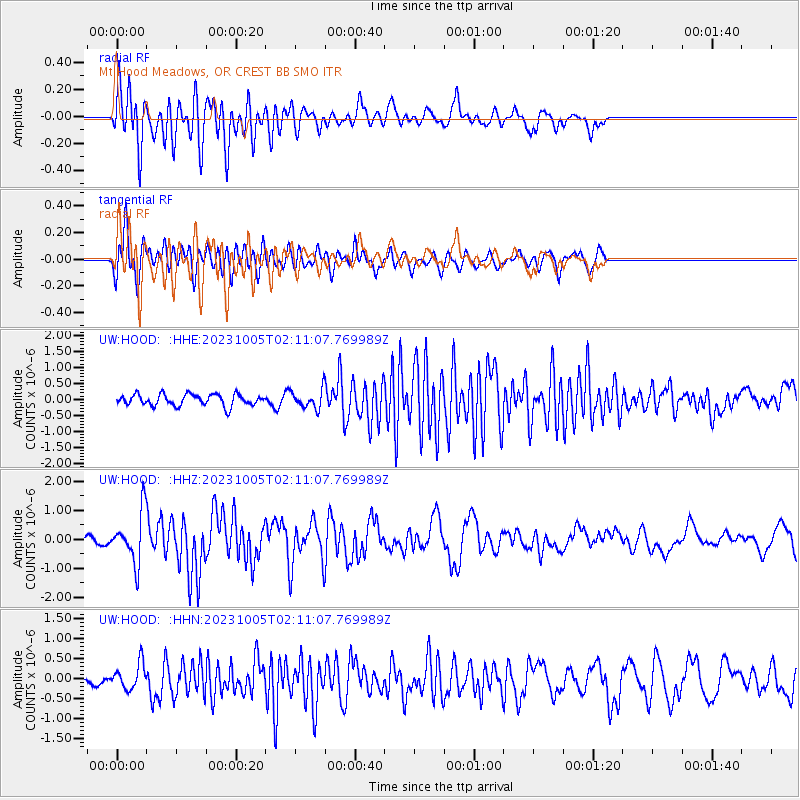
HOOD Mt Hood Meadows, OR CREST BB SMO - Earthquake Result Viewer
*The percent match for this event was below the threshold and hence no stack was calculated.
| Earthquake location: |
Southeast Of Honshu, Japan |
| Earthquake latitude/longitude: |
30.0/139.9 |
| Earthquake time(UTC): |
2023/10/05 (278) 01:59:58 GMT |
| Earthquake Depth: |
10 km |
| Earthquake Magnitude: |
6.1 mww |
| Earthquake Catalog/Contributor: |
NEIC PDE/us |
|
| Network: |
UW Pacific Northwest Regional Seismic Network |
| Station: |
HOOD Mt Hood Meadows, OR CREST BB SMO |
| Lat/Lon: |
45.32 N/121.65 W |
| Elevation: |
1520 m |
|
| Distance: |
74.8 deg |
| Az: |
46.332 deg |
| Baz: |
297.156 deg |
| Ray Param: |
$rayparam |
*The percent match for this event was below the threshold and hence was not used in the summary stack. |
|
| Radial Match: |
78.53313 % |
| Radial Bump: |
400 |
| Transverse Match: |
78.84801 % |
| Transverse Bump: |
400 |
| SOD ConfigId: |
31937991 |
| Insert Time: |
2023-10-19 02:34:23.176 +0000 |
| GWidth: |
2.5 |
| Max Bumps: |
400 |
| Tol: |
0.001 |
|
Signal To Noise
| Channel | StoN | STA | LTA |
| UW:HOOD: :HHZ:20231005T02:11:07.769989Z | 6.468477 | 8.755063E-7 | 1.353497E-7 |
| UW:HOOD: :HHN:20231005T02:11:07.769989Z | 2.6158016 | 3.233552E-7 | 1.236161E-7 |
| UW:HOOD: :HHE:20231005T02:11:07.769989Z | 1.6148417 | 2.846556E-7 | 1.7627463E-7 |
| Arrivals |
| Ps | |
| PpPs | |
| PsPs/PpSs | |


