You are here: Home > Network List > GM - US Geological Survey Networks Stations List
> Station IWM01 Jericho 2M Well Monitoring Station > Earthquake Result Viewer
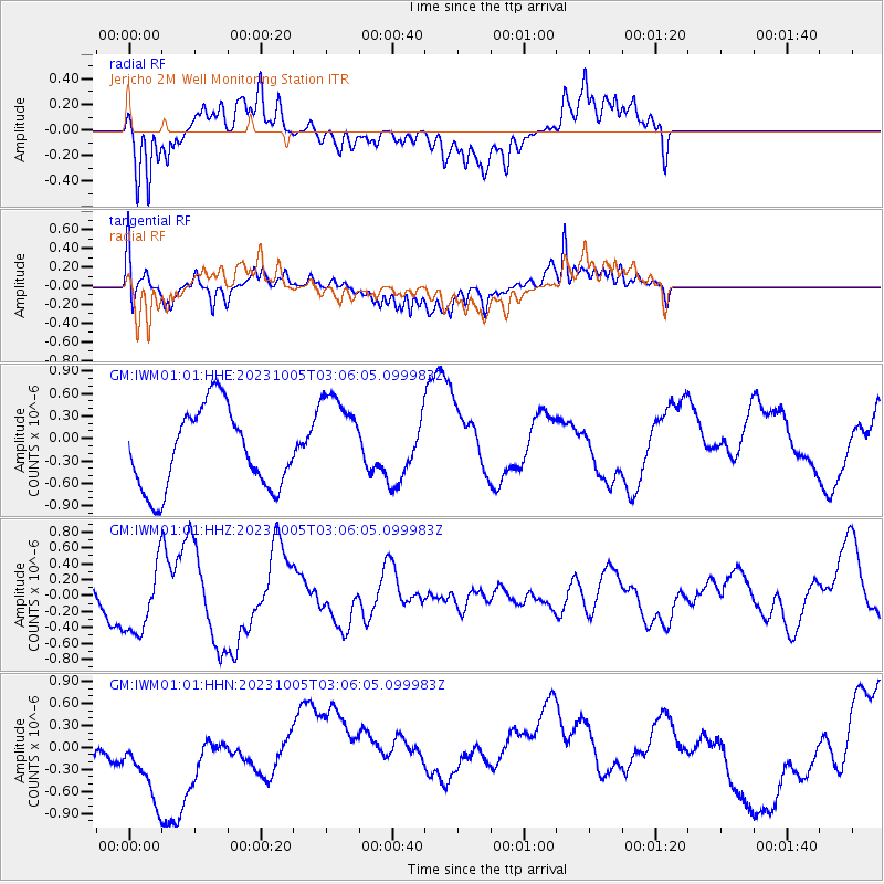
IWM01 Jericho 2M Well Monitoring Station - Earthquake Result Viewer
*The percent match for this event was below the threshold and hence no stack was calculated.
| Earthquake location: |
Southeast Of Honshu, Japan |
| Earthquake latitude/longitude: |
30.0/139.8 |
| Earthquake time(UTC): |
2023/10/05 (278) 02:53:13 GMT |
| Earthquake Depth: |
10 km |
| Earthquake Magnitude: |
5.7 Mww |
| Earthquake Catalog/Contributor: |
NEIC PDE/us |
|
| Network: |
GM US Geological Survey Networks |
| Station: |
IWM01 Jericho 2M Well Monitoring Station |
| Lat/Lon: |
36.73 N/96.53 W |
| Elevation: |
328 m |
|
| Distance: |
95.2 deg |
| Az: |
42.191 deg |
| Baz: |
313.521 deg |
| Ray Param: |
$rayparam |
*The percent match for this event was below the threshold and hence was not used in the summary stack. |
|
| Radial Match: |
66.86011 % |
| Radial Bump: |
400 |
| Transverse Match: |
51.13431 % |
| Transverse Bump: |
400 |
| SOD ConfigId: |
31937991 |
| Insert Time: |
2023-10-19 03:05:02.923 +0000 |
| GWidth: |
2.5 |
| Max Bumps: |
400 |
| Tol: |
0.001 |
|
Signal To Noise
| Channel | StoN | STA | LTA |
| GM:IWM01:01:HHZ:20231005T03:06:05.099983Z | 2.2114694 | 4.3715778E-7 | 1.9767752E-7 |
| GM:IWM01:01:HHN:20231005T03:06:05.099983Z | 2.482216 | 7.646685E-7 | 3.0805884E-7 |
| GM:IWM01:01:HHE:20231005T03:06:05.099983Z | 1.2195538 | 6.445417E-7 | 5.285061E-7 |
| Arrivals |
| Ps | |
| PpPs | |
| PsPs/PpSs | |


