You are here: Home > Network List > IW - Intermountain West Stations List
> Station DLMT Dillon, Montana, USA > Earthquake Result Viewer
DLMT Dillon, Montana, USA - Earthquake Result Viewer
*The percent match for this event was below the threshold and hence no stack was calculated.
| Earthquake location: |
Southeast Of Honshu, Japan |
| Earthquake latitude/longitude: |
30.0/140.0 |
| Earthquake time(UTC): |
2023/10/06 (279) 01:31:17 GMT |
| Earthquake Depth: |
10 km |
| Earthquake Magnitude: |
6.1 mww |
| Earthquake Catalog/Contributor: |
NEIC PDE/us |
|
| Network: |
IW Intermountain West |
| Station: |
DLMT Dillon, Montana, USA |
| Lat/Lon: |
45.36 N/112.60 W |
| Elevation: |
1569 m |
|
| Distance: |
80.2 deg |
| Az: |
43.058 deg |
| Baz: |
302.89 deg |
| Ray Param: |
$rayparam |
*The percent match for this event was below the threshold and hence was not used in the summary stack. |
|
| Radial Match: |
77.59629 % |
| Radial Bump: |
400 |
| Transverse Match: |
69.05971 % |
| Transverse Bump: |
400 |
| SOD ConfigId: |
31937991 |
| Insert Time: |
2023-10-20 01:47:43.499 +0000 |
| GWidth: |
2.5 |
| Max Bumps: |
400 |
| Tol: |
0.001 |
|
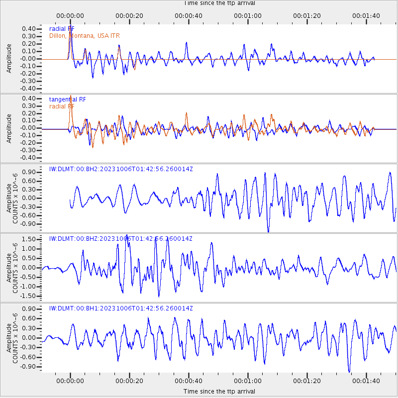
Signal To Noise
| Channel | StoN | STA | LTA |
| IW:DLMT:00:BHZ:20231006T01:42:56.260014Z | 3.8374417 | 4.3654296E-7 | 1.1375885E-7 |
| IW:DLMT:00:BH1:20231006T01:42:56.260014Z | 1.7835132 | 2.4185013E-7 | 1.3560323E-7 |
| IW:DLMT:00:BH2:20231006T01:42:56.260014Z | 0.5130494 | 1.1971399E-7 | 2.3333813E-7 |
| Arrivals |
| Ps | |
| PpPs | |
| PsPs/PpSs | |


