You are here: Home > Network List > US - United States National Seismic Network Stations List
> Station MSO Missoula, Montana, USA > Earthquake Result Viewer
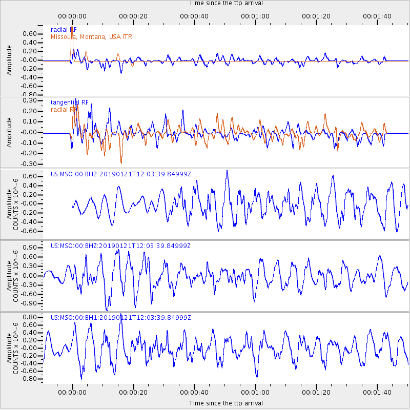
MSO Missoula, Montana, USA - Earthquake Result Viewer
*The percent match for this event was below the threshold and hence no stack was calculated.
| Earthquake location: |
Near Coast Of Oaxaca, Mexico |
| Earthquake latitude/longitude: |
15.6/-94.7 |
| Earthquake time(UTC): |
2019/01/21 (021) 11:57:17 GMT |
| Earthquake Depth: |
10 km |
| Earthquake Magnitude: |
5.8 Mww |
| Earthquake Catalog/Contributor: |
NEIC PDE/us |
|
| Network: |
US United States National Seismic Network |
| Station: |
MSO Missoula, Montana, USA |
| Lat/Lon: |
46.83 N/113.94 W |
| Elevation: |
1264 m |
|
| Distance: |
35.0 deg |
| Az: |
336.821 deg |
| Baz: |
146.463 deg |
| Ray Param: |
$rayparam |
*The percent match for this event was below the threshold and hence was not used in the summary stack. |
|
| Radial Match: |
64.54711 % |
| Radial Bump: |
400 |
| Transverse Match: |
71.116776 % |
| Transverse Bump: |
400 |
| SOD ConfigId: |
3260311 |
| Insert Time: |
2019-02-04 12:01:47.400 +0000 |
| GWidth: |
2.5 |
| Max Bumps: |
400 |
| Tol: |
0.001 |
|
Signal To Noise
| Channel | StoN | STA | LTA |
| US:MSO:00:BHZ:20190121T12:03:39.84999Z | 1.260151 | 3.1096752E-7 | 2.4677004E-7 |
| US:MSO:00:BH1:20190121T12:03:39.84999Z | 2.160195 | 4.1289218E-7 | 1.9113654E-7 |
| US:MSO:00:BH2:20190121T12:03:39.84999Z | 1.2118566 | 2.133625E-7 | 1.7606249E-7 |
| Arrivals |
| Ps | |
| PpPs | |
| PsPs/PpSs | |


