You are here: Home > Network List > WY - Yellowstone Wyoming Seismic Network Stations List
> Station YHH Holmes Hill, YNP, WY, USA > Earthquake Result Viewer
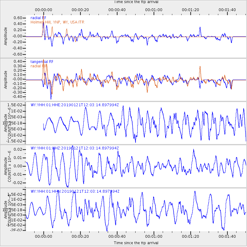
YHH Holmes Hill, YNP, WY, USA - Earthquake Result Viewer
*The percent match for this event was below the threshold and hence no stack was calculated.
| Earthquake location: |
Near Coast Of Oaxaca, Mexico |
| Earthquake latitude/longitude: |
15.6/-94.7 |
| Earthquake time(UTC): |
2019/01/21 (021) 11:57:17 GMT |
| Earthquake Depth: |
10 km |
| Earthquake Magnitude: |
5.8 Mww |
| Earthquake Catalog/Contributor: |
NEIC PDE/us |
|
| Network: |
WY Yellowstone Wyoming Seismic Network |
| Station: |
YHH Holmes Hill, YNP, WY, USA |
| Lat/Lon: |
44.79 N/110.85 W |
| Elevation: |
2717 m |
|
| Distance: |
32.2 deg |
| Az: |
338.192 deg |
| Baz: |
149.814 deg |
| Ray Param: |
$rayparam |
*The percent match for this event was below the threshold and hence was not used in the summary stack. |
|
| Radial Match: |
69.63515 % |
| Radial Bump: |
385 |
| Transverse Match: |
69.769066 % |
| Transverse Bump: |
400 |
| SOD ConfigId: |
3260311 |
| Insert Time: |
2019-02-04 12:02:10.081 +0000 |
| GWidth: |
2.5 |
| Max Bumps: |
400 |
| Tol: |
0.001 |
|
Signal To Noise
| Channel | StoN | STA | LTA |
| WY:YHH:01:HHZ:20190121T12:03:14.897994Z | 1.8255603 | 1.2676839E-8 | 6.9440813E-9 |
| WY:YHH:01:HHN:20190121T12:03:14.897994Z | 1.1088401 | 8.156888E-9 | 7.3562343E-9 |
| WY:YHH:01:HHE:20190121T12:03:14.897994Z | 1.2690079 | 6.125751E-9 | 4.827197E-9 |
| Arrivals |
| Ps | |
| PpPs | |
| PsPs/PpSs | |


