You are here: Home > Network List > CI - Caltech Regional Seismic Network Stations List
> Station LGU LGU, Camarillo, CA, USA > Earthquake Result Viewer
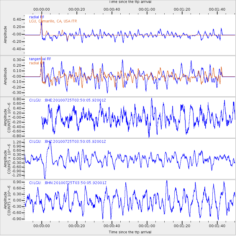
LGU LGU, Camarillo, CA, USA - Earthquake Result Viewer
*The percent match for this event was below the threshold and hence no stack was calculated.
| Earthquake location: |
Tonga Islands |
| Earthquake latitude/longitude: |
-15.1/-173.5 |
| Earthquake time(UTC): |
2010/07/25 (206) 03:39:17 GMT |
| Earthquake Depth: |
7.0 km |
| Earthquake Magnitude: |
5.6 MB, 5.7 MS, 5.9 MW, 5.9 MW |
| Earthquake Catalog/Contributor: |
WHDF/NEIC |
|
| Network: |
CI Caltech Regional Seismic Network |
| Station: |
LGU LGU, Camarillo, CA, USA |
| Lat/Lon: |
34.11 N/119.07 W |
| Elevation: |
416 m |
|
| Distance: |
71.2 deg |
| Az: |
45.495 deg |
| Baz: |
236.137 deg |
| Ray Param: |
$rayparam |
*The percent match for this event was below the threshold and hence was not used in the summary stack. |
|
| Radial Match: |
57.458645 % |
| Radial Bump: |
400 |
| Transverse Match: |
67.027916 % |
| Transverse Bump: |
400 |
| SOD ConfigId: |
319893 |
| Insert Time: |
2011-01-05 10:43:46.953 +0000 |
| GWidth: |
2.5 |
| Max Bumps: |
400 |
| Tol: |
0.001 |
|
Signal To Noise
| Channel | StoN | STA | LTA |
| CI:LGU: :BHZ:20100725T03:50:05.92001Z | 2.8796947 | 7.741037E-7 | 2.688145E-7 |
| CI:LGU: :BHN:20100725T03:50:05.92001Z | 1.2452703 | 2.6993163E-7 | 2.167655E-7 |
| CI:LGU: :BHE:20100725T03:50:05.92001Z | 1.0746937 | 3.0880437E-7 | 2.8734178E-7 |
| Arrivals |
| Ps | |
| PpPs | |
| PsPs/PpSs | |


