You are here: Home > Network List > IU - Global Seismograph Network (GSN - IRIS/USGS) Stations List
> Station JOHN Johnston Island, USA > Earthquake Result Viewer
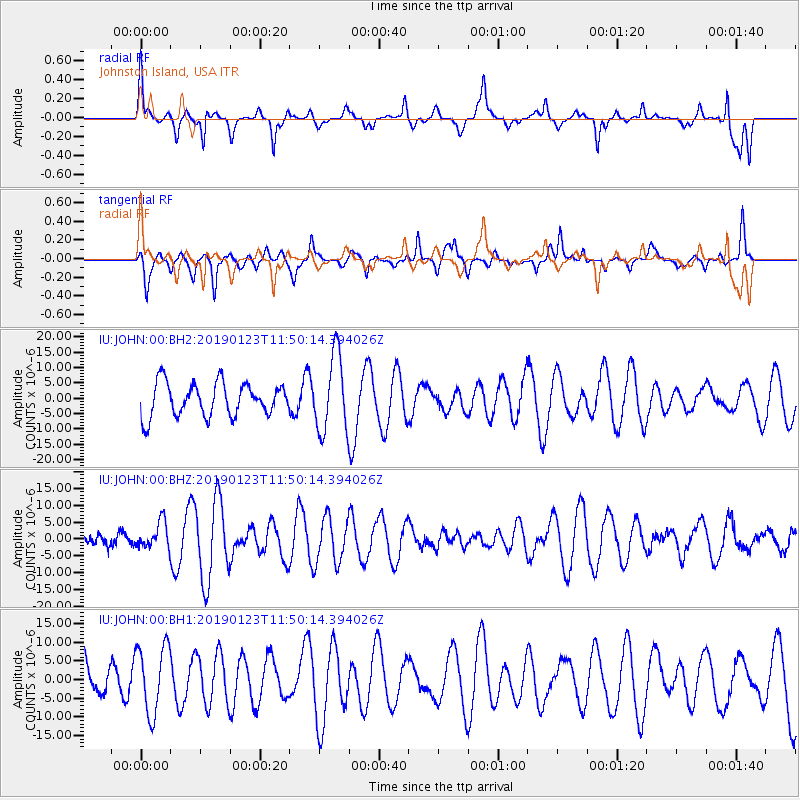
JOHN Johnston Island, USA - Earthquake Result Viewer
*The percent match for this event was below the threshold and hence no stack was calculated.
| Earthquake location: |
South Of Sumbawa, Indonesia |
| Earthquake latitude/longitude: |
-10.3/118.9 |
| Earthquake time(UTC): |
2019/01/23 (023) 11:39:01 GMT |
| Earthquake Depth: |
15 km |
| Earthquake Magnitude: |
5.5 Mww |
| Earthquake Catalog/Contributor: |
NEIC PDE/us |
|
| Network: |
IU Global Seismograph Network (GSN - IRIS/USGS) |
| Station: |
JOHN Johnston Island, USA |
| Lat/Lon: |
16.73 N/169.53 W |
| Elevation: |
2.0 m |
|
| Distance: |
75.7 deg |
| Az: |
69.739 deg |
| Baz: |
254.466 deg |
| Ray Param: |
$rayparam |
*The percent match for this event was below the threshold and hence was not used in the summary stack. |
|
| Radial Match: |
60.85737 % |
| Radial Bump: |
400 |
| Transverse Match: |
63.240917 % |
| Transverse Bump: |
345 |
| SOD ConfigId: |
3260311 |
| Insert Time: |
2019-02-06 11:52:44.211 +0000 |
| GWidth: |
2.5 |
| Max Bumps: |
400 |
| Tol: |
0.001 |
|
Signal To Noise
| Channel | StoN | STA | LTA |
| IU:JOHN:00:BHZ:20190123T11:50:14.394026Z | 0.79952234 | 3.9609695E-6 | 4.95417E-6 |
| IU:JOHN:00:BH1:20190123T11:50:14.394026Z | 1.3122193 | 9.156433E-6 | 6.9778225E-6 |
| IU:JOHN:00:BH2:20190123T11:50:14.394026Z | 2.3261423 | 1.2500265E-5 | 5.3738177E-6 |
| Arrivals |
| Ps | |
| PpPs | |
| PsPs/PpSs | |


