You are here: Home > Network List > TA - USArray Transportable Network (new EarthScope stations) Stations List
> Station S30A Montezuma, KS, USA > Earthquake Result Viewer
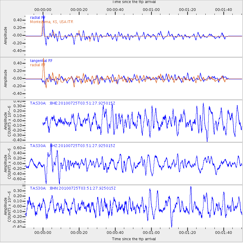
S30A Montezuma, KS, USA - Earthquake Result Viewer
*The percent match for this event was below the threshold and hence no stack was calculated.
| Earthquake location: |
Tonga Islands |
| Earthquake latitude/longitude: |
-15.1/-173.5 |
| Earthquake time(UTC): |
2010/07/25 (206) 03:39:17 GMT |
| Earthquake Depth: |
7.0 km |
| Earthquake Magnitude: |
5.6 MB, 5.7 MS, 5.9 MW, 5.9 MW |
| Earthquake Catalog/Contributor: |
WHDF/NEIC |
|
| Network: |
TA USArray Transportable Network (new EarthScope stations) |
| Station: |
S30A Montezuma, KS, USA |
| Lat/Lon: |
37.64 N/100.46 W |
| Elevation: |
853 m |
|
| Distance: |
86.2 deg |
| Az: |
49.566 deg |
| Baz: |
247.861 deg |
| Ray Param: |
$rayparam |
*The percent match for this event was below the threshold and hence was not used in the summary stack. |
|
| Radial Match: |
78.37454 % |
| Radial Bump: |
398 |
| Transverse Match: |
63.425545 % |
| Transverse Bump: |
400 |
| SOD ConfigId: |
319893 |
| Insert Time: |
2011-01-05 11:01:17.496 +0000 |
| GWidth: |
2.5 |
| Max Bumps: |
400 |
| Tol: |
0.001 |
|
Signal To Noise
| Channel | StoN | STA | LTA |
| TA:S30A: :BHZ:20100725T03:51:27.925015Z | 6.38015 | 3.8983768E-7 | 6.110165E-8 |
| TA:S30A: :BHN:20100725T03:51:27.925015Z | 1.4430802 | 1.10591095E-7 | 7.6635445E-8 |
| TA:S30A: :BHE:20100725T03:51:27.925015Z | 2.2787337 | 1.6399513E-7 | 7.1967655E-8 |
| Arrivals |
| Ps | |
| PpPs | |
| PsPs/PpSs | |


