You are here: Home > Network List > CN - Canadian National Seismograph Network Stations List
> Station INK INUVIK, NT > Earthquake Result Viewer
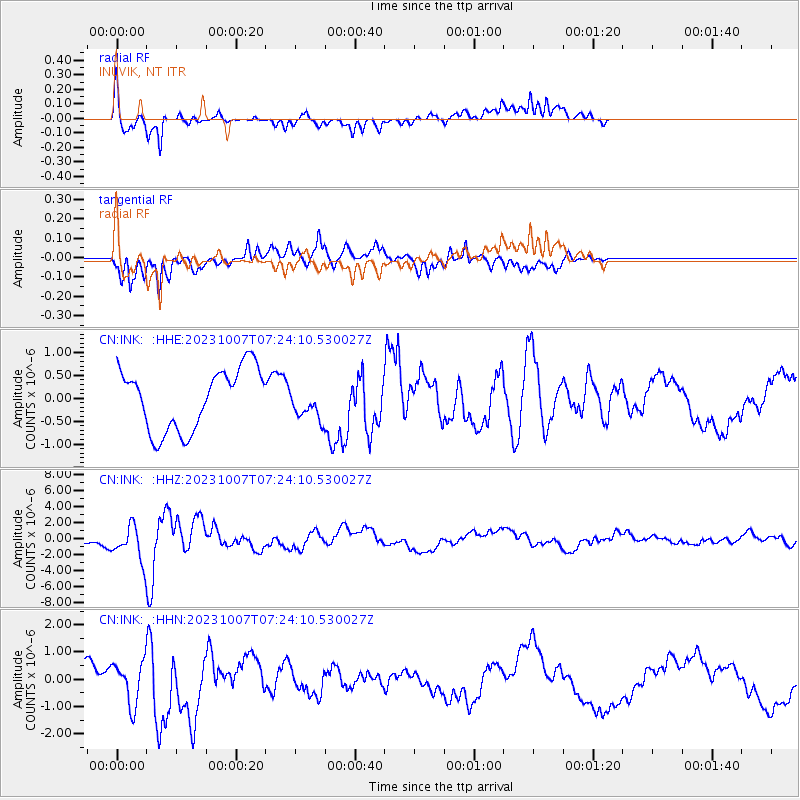
INK INUVIK, NT - Earthquake Result Viewer
*The percent match for this event was below the threshold and hence no stack was calculated.
| Earthquake location: |
Northwestern Afghanistan |
| Earthquake latitude/longitude: |
34.5/61.9 |
| Earthquake time(UTC): |
2023/10/07 (280) 07:12:50 GMT |
| Earthquake Depth: |
11 km |
| Earthquake Magnitude: |
6.2 mww |
| Earthquake Catalog/Contributor: |
NEIC PDE/us |
|
| Network: |
CN Canadian National Seismograph Network |
| Station: |
INK INUVIK, NT |
| Lat/Lon: |
68.31 N/133.53 W |
| Elevation: |
44 m |
|
| Distance: |
76.8 deg |
| Az: |
5.824 deg |
| Baz: |
346.981 deg |
| Ray Param: |
$rayparam |
*The percent match for this event was below the threshold and hence was not used in the summary stack. |
|
| Radial Match: |
72.76985 % |
| Radial Bump: |
400 |
| Transverse Match: |
72.20655 % |
| Transverse Bump: |
400 |
| SOD ConfigId: |
31937991 |
| Insert Time: |
2023-10-21 07:59:08.876 +0000 |
| GWidth: |
2.5 |
| Max Bumps: |
400 |
| Tol: |
0.001 |
|
Signal To Noise
| Channel | StoN | STA | LTA |
| CN:INK: :HHZ:20231007T07:24:10.530027Z | 2.6239164 | 2.1481362E-6 | 8.186755E-7 |
| CN:INK: :HHN:20231007T07:24:10.530027Z | 1.6168182 | 7.6891484E-7 | 4.7557285E-7 |
| CN:INK: :HHE:20231007T07:24:10.530027Z | 0.5001803 | 3.3510506E-7 | 6.699685E-7 |
| Arrivals |
| Ps | |
| PpPs | |
| PsPs/PpSs | |


