You are here: Home > Network List > TA - USArray Transportable Network (new EarthScope stations) Stations List
> Station H27A Howes, SD, USA > Earthquake Result Viewer
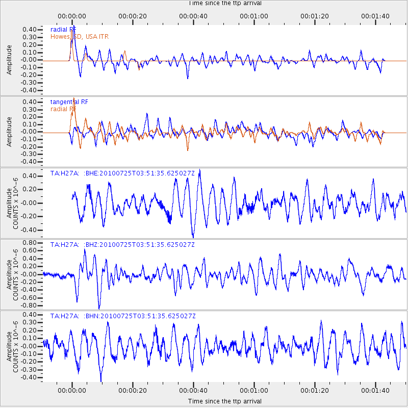
H27A Howes, SD, USA - Earthquake Result Viewer
*The percent match for this event was below the threshold and hence no stack was calculated.
| Earthquake location: |
Tonga Islands |
| Earthquake latitude/longitude: |
-15.1/-173.5 |
| Earthquake time(UTC): |
2010/07/25 (206) 03:39:17 GMT |
| Earthquake Depth: |
7.0 km |
| Earthquake Magnitude: |
5.6 MB, 5.7 MS, 5.9 MW, 5.9 MW |
| Earthquake Catalog/Contributor: |
WHDF/NEIC |
|
| Network: |
TA USArray Transportable Network (new EarthScope stations) |
| Station: |
H27A Howes, SD, USA |
| Lat/Lon: |
44.63 N/102.08 W |
| Elevation: |
748 m |
|
| Distance: |
87.8 deg |
| Az: |
42.646 deg |
| Baz: |
246.44 deg |
| Ray Param: |
$rayparam |
*The percent match for this event was below the threshold and hence was not used in the summary stack. |
|
| Radial Match: |
65.9807 % |
| Radial Bump: |
396 |
| Transverse Match: |
62.829166 % |
| Transverse Bump: |
400 |
| SOD ConfigId: |
319893 |
| Insert Time: |
2011-01-05 11:03:51.249 +0000 |
| GWidth: |
2.5 |
| Max Bumps: |
400 |
| Tol: |
0.001 |
|
Signal To Noise
| Channel | StoN | STA | LTA |
| TA:H27A: :BHZ:20100725T03:51:35.625027Z | 4.604628 | 3.2255943E-7 | 7.0051136E-8 |
| TA:H27A: :BHN:20100725T03:51:35.625027Z | 1.7023084 | 1.7550975E-7 | 1.0310103E-7 |
| TA:H27A: :BHE:20100725T03:51:35.625027Z | 1.3153639 | 1.8942671E-7 | 1.4401088E-7 |
| Arrivals |
| Ps | |
| PpPs | |
| PsPs/PpSs | |


