You are here: Home > Network List > US - United States National Seismic Network Stations List
> Station AGMN Agassiz National Wildlife Refuge, Minnesota, USA > Earthquake Result Viewer
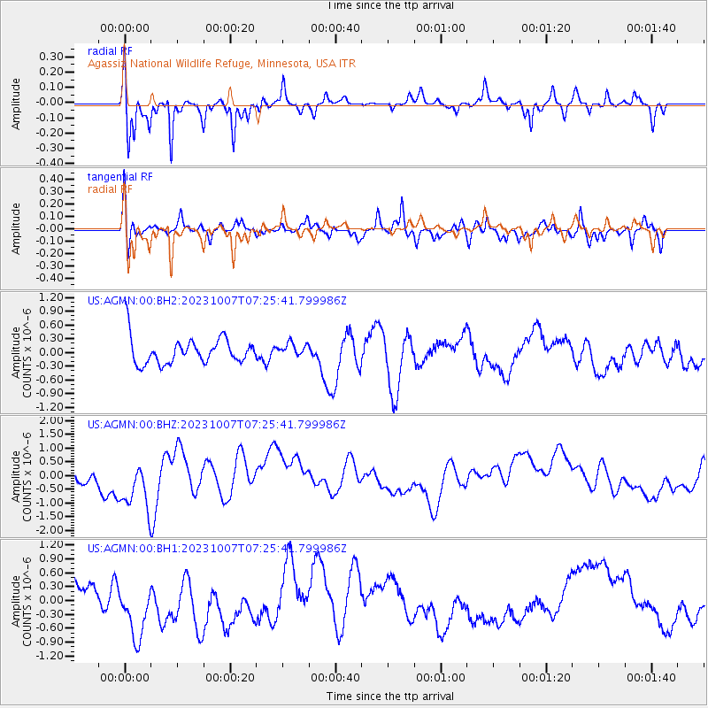
AGMN Agassiz National Wildlife Refuge, Minnesota, USA - Earthquake Result Viewer
*The percent match for this event was below the threshold and hence no stack was calculated.
| Earthquake location: |
Northwestern Afghanistan |
| Earthquake latitude/longitude: |
34.5/61.9 |
| Earthquake time(UTC): |
2023/10/07 (280) 07:12:50 GMT |
| Earthquake Depth: |
11 km |
| Earthquake Magnitude: |
6.2 mww |
| Earthquake Catalog/Contributor: |
NEIC PDE/us |
|
| Network: |
US United States National Seismic Network |
| Station: |
AGMN Agassiz National Wildlife Refuge, Minnesota, USA |
| Lat/Lon: |
48.30 N/95.86 W |
| Elevation: |
351 m |
|
| Distance: |
95.2 deg |
| Az: |
345.291 deg |
| Baz: |
18.292 deg |
| Ray Param: |
$rayparam |
*The percent match for this event was below the threshold and hence was not used in the summary stack. |
|
| Radial Match: |
84.26363 % |
| Radial Bump: |
365 |
| Transverse Match: |
60.661785 % |
| Transverse Bump: |
400 |
| SOD ConfigId: |
31937991 |
| Insert Time: |
2023-10-21 08:13:56.470 +0000 |
| GWidth: |
2.5 |
| Max Bumps: |
400 |
| Tol: |
0.001 |
|
Signal To Noise
| Channel | StoN | STA | LTA |
| US:AGMN:00:BHZ:20231007T07:25:41.799986Z | 3.565457 | 1.0345404E-6 | 2.9015646E-7 |
| US:AGMN:00:BH1:20231007T07:25:41.799986Z | 2.340726 | 6.880495E-7 | 2.9394704E-7 |
| US:AGMN:00:BH2:20231007T07:25:41.799986Z | 0.5025317 | 1.4604207E-7 | 2.9061263E-7 |
| Arrivals |
| Ps | |
| PpPs | |
| PsPs/PpSs | |


