You are here: Home > Network List > US - United States National Seismic Network Stations List
> Station EGMT Eagleton, Montana, USA > Earthquake Result Viewer
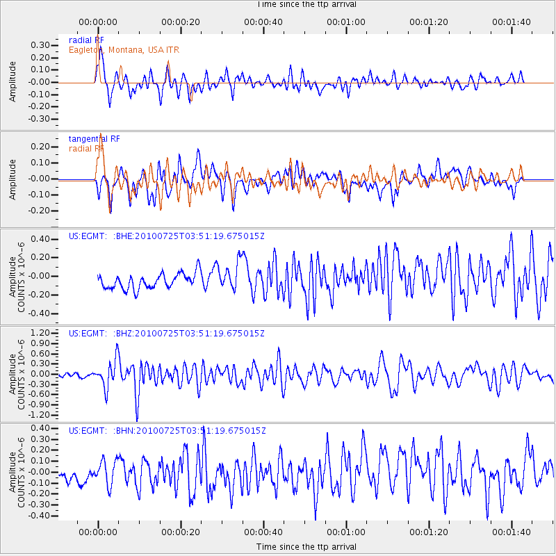
EGMT Eagleton, Montana, USA - Earthquake Result Viewer
*The percent match for this event was below the threshold and hence no stack was calculated.
| Earthquake location: |
Tonga Islands |
| Earthquake latitude/longitude: |
-15.1/-173.5 |
| Earthquake time(UTC): |
2010/07/25 (206) 03:39:17 GMT |
| Earthquake Depth: |
7.0 km |
| Earthquake Magnitude: |
5.6 MB, 5.7 MS, 5.9 MW, 5.9 MW |
| Earthquake Catalog/Contributor: |
WHDF/NEIC |
|
| Network: |
US United States National Seismic Network |
| Station: |
EGMT Eagleton, Montana, USA |
| Lat/Lon: |
48.02 N/109.75 W |
| Elevation: |
1055 m |
|
| Distance: |
84.6 deg |
| Az: |
37.231 deg |
| Baz: |
240.537 deg |
| Ray Param: |
$rayparam |
*The percent match for this event was below the threshold and hence was not used in the summary stack. |
|
| Radial Match: |
74.92875 % |
| Radial Bump: |
400 |
| Transverse Match: |
57.323788 % |
| Transverse Bump: |
400 |
| SOD ConfigId: |
319893 |
| Insert Time: |
2011-01-05 11:22:28.887 +0000 |
| GWidth: |
2.5 |
| Max Bumps: |
400 |
| Tol: |
0.001 |
|
Signal To Noise
| Channel | StoN | STA | LTA |
| US:EGMT: :BHZ:20100725T03:51:19.675015Z | 9.3220005 | 4.0757376E-7 | 4.3721705E-8 |
| US:EGMT: :BHN:20100725T03:51:19.675015Z | 1.0111394 | 1.2324686E-7 | 1.218891E-7 |
| US:EGMT: :BHE:20100725T03:51:19.675015Z | 1.9284499 | 1.5525619E-7 | 8.0508286E-8 |
| Arrivals |
| Ps | |
| PpPs | |
| PsPs/PpSs | |


