You are here: Home > Network List > UW - Pacific Northwest Regional Seismic Network Stations List
> Station MRBL Marblemount, WA, USA > Earthquake Result Viewer
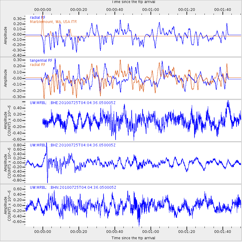
MRBL Marblemount, WA, USA - Earthquake Result Viewer
*The percent match for this event was below the threshold and hence no stack was calculated.
| Earthquake location: |
Taiwan |
| Earthquake latitude/longitude: |
22.8/120.8 |
| Earthquake time(UTC): |
2010/07/25 (206) 03:52:11 GMT |
| Earthquake Depth: |
32 km |
| Earthquake Magnitude: |
5.7 ML, 5.4 MB |
| Earthquake Catalog/Contributor: |
WHDF/NEIC |
|
| Network: |
UW Pacific Northwest Regional Seismic Network |
| Station: |
MRBL Marblemount, WA, USA |
| Lat/Lon: |
48.52 N/121.48 W |
| Elevation: |
75 m |
|
| Distance: |
89.9 deg |
| Az: |
36.073 deg |
| Baz: |
305.169 deg |
| Ray Param: |
$rayparam |
*The percent match for this event was below the threshold and hence was not used in the summary stack. |
|
| Radial Match: |
53.801125 % |
| Radial Bump: |
400 |
| Transverse Match: |
53.02093 % |
| Transverse Bump: |
400 |
| SOD ConfigId: |
319893 |
| Insert Time: |
2011-01-05 11:29:51.459 +0000 |
| GWidth: |
2.5 |
| Max Bumps: |
400 |
| Tol: |
0.001 |
|
Signal To Noise
| Channel | StoN | STA | LTA |
| UW:MRBL: :BHZ:20100725T04:04:36.050005Z | 3.1678598 | 3.4330057E-7 | 1.08369875E-7 |
| UW:MRBL: :BHN:20100725T04:04:36.050005Z | 1.623109 | 1.8271014E-7 | 1.1256801E-7 |
| UW:MRBL: :BHE:20100725T04:04:36.050005Z | 1.0370218 | 1.5365801E-7 | 1.481724E-7 |
| Arrivals |
| Ps | |
| PpPs | |
| PsPs/PpSs | |


