You are here: Home > Network List > CI - Caltech Regional Seismic Network Stations List
> Station MPM Manuel Prospect Mine, California, USA > Earthquake Result Viewer
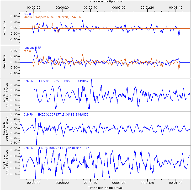
MPM Manuel Prospect Mine, California, USA - Earthquake Result Viewer
*The percent match for this event was below the threshold and hence no stack was calculated.
| Earthquake location: |
Kuril Islands |
| Earthquake latitude/longitude: |
49.7/154.6 |
| Earthquake time(UTC): |
2010/07/25 (206) 12:57:01 GMT |
| Earthquake Depth: |
130 km |
| Earthquake Magnitude: |
5.7 MB, 5.6 MW, 5.6 MW |
| Earthquake Catalog/Contributor: |
WHDF/NEIC |
|
| Network: |
CI Caltech Regional Seismic Network |
| Station: |
MPM Manuel Prospect Mine, California, USA |
| Lat/Lon: |
36.06 N/117.49 W |
| Elevation: |
185 m |
|
| Distance: |
62.3 deg |
| Az: |
66.171 deg |
| Baz: |
312.864 deg |
| Ray Param: |
$rayparam |
*The percent match for this event was below the threshold and hence was not used in the summary stack. |
|
| Radial Match: |
48.806515 % |
| Radial Bump: |
400 |
| Transverse Match: |
62.823486 % |
| Transverse Bump: |
400 |
| SOD ConfigId: |
319893 |
| Insert Time: |
2011-01-05 11:35:58.786 +0000 |
| GWidth: |
2.5 |
| Max Bumps: |
400 |
| Tol: |
0.001 |
|
Signal To Noise
| Channel | StoN | STA | LTA |
| CI:MPM: :BHZ:20100725T13:06:38.844985Z | 2.379427 | 2.1945401E-7 | 9.222977E-8 |
| CI:MPM: :BHN:20100725T13:06:38.844985Z | 1.4669707 | 9.859853E-8 | 6.721233E-8 |
| CI:MPM: :BHE:20100725T13:06:38.844985Z | 0.7463827 | 8.3994664E-8 | 1.1253566E-7 |
| Arrivals |
| Ps | |
| PpPs | |
| PsPs/PpSs | |


