You are here: Home > Network List > CI - Caltech Regional Seismic Network Stations List
> Station SMM Simmler, CA, USA > Earthquake Result Viewer
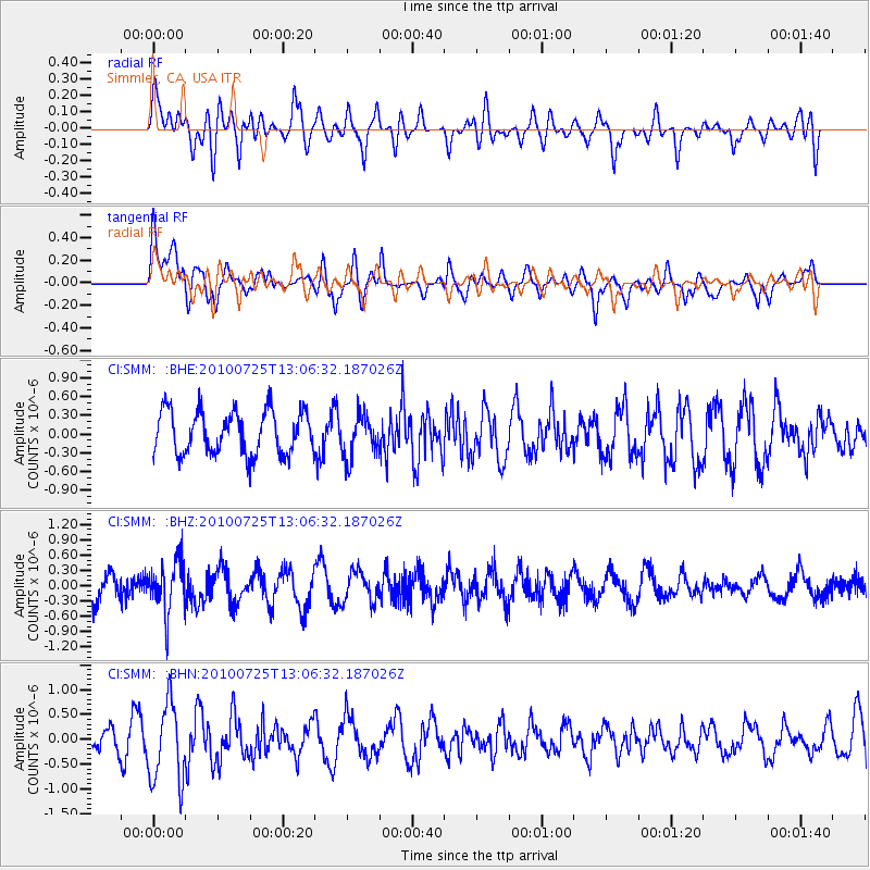
SMM Simmler, CA, USA - Earthquake Result Viewer
*The percent match for this event was below the threshold and hence no stack was calculated.
| Earthquake location: |
Kuril Islands |
| Earthquake latitude/longitude: |
49.7/154.6 |
| Earthquake time(UTC): |
2010/07/25 (206) 12:57:01 GMT |
| Earthquake Depth: |
130 km |
| Earthquake Magnitude: |
5.7 MB, 5.6 MW, 5.6 MW |
| Earthquake Catalog/Contributor: |
WHDF/NEIC |
|
| Network: |
CI Caltech Regional Seismic Network |
| Station: |
SMM Simmler, CA, USA |
| Lat/Lon: |
35.31 N/120.00 W |
| Elevation: |
599 m |
|
| Distance: |
61.3 deg |
| Az: |
68.36 deg |
| Baz: |
312.443 deg |
| Ray Param: |
$rayparam |
*The percent match for this event was below the threshold and hence was not used in the summary stack. |
|
| Radial Match: |
51.112617 % |
| Radial Bump: |
400 |
| Transverse Match: |
56.60709 % |
| Transverse Bump: |
400 |
| SOD ConfigId: |
319893 |
| Insert Time: |
2011-01-05 11:36:23.297 +0000 |
| GWidth: |
2.5 |
| Max Bumps: |
400 |
| Tol: |
0.001 |
|
Signal To Noise
| Channel | StoN | STA | LTA |
| CI:SMM: :BHZ:20100725T13:06:32.187026Z | 1.4478742 | 4.980834E-7 | 3.4401018E-7 |
| CI:SMM: :BHN:20100725T13:06:32.187026Z | 4.318367 | 7.919748E-7 | 1.8339682E-7 |
| CI:SMM: :BHE:20100725T13:06:32.187026Z | 0.99585176 | 3.4340164E-7 | 3.4483207E-7 |
| Arrivals |
| Ps | |
| PpPs | |
| PsPs/PpSs | |


