You are here: Home > Network List > IW - Intermountain West Stations List
> Station MOOW Moose Ponds, Wyoming, USA > Earthquake Result Viewer
MOOW Moose Ponds, Wyoming, USA - Earthquake Result Viewer
*The percent match for this event was below the threshold and hence no stack was calculated.
| Earthquake location: |
Kuril Islands |
| Earthquake latitude/longitude: |
49.7/154.6 |
| Earthquake time(UTC): |
2010/07/25 (206) 12:57:01 GMT |
| Earthquake Depth: |
130 km |
| Earthquake Magnitude: |
5.7 MB, 5.6 MW, 5.6 MW |
| Earthquake Catalog/Contributor: |
WHDF/NEIC |
|
| Network: |
IW Intermountain West |
| Station: |
MOOW Moose Ponds, Wyoming, USA |
| Lat/Lon: |
43.75 N/110.74 W |
| Elevation: |
2128 m |
|
| Distance: |
60.9 deg |
| Az: |
55.753 deg |
| Baz: |
312.218 deg |
| Ray Param: |
$rayparam |
*The percent match for this event was below the threshold and hence was not used in the summary stack. |
|
| Radial Match: |
75.02844 % |
| Radial Bump: |
400 |
| Transverse Match: |
68.16541 % |
| Transverse Bump: |
400 |
| SOD ConfigId: |
319893 |
| Insert Time: |
2011-01-05 11:41:19.386 +0000 |
| GWidth: |
2.5 |
| Max Bumps: |
400 |
| Tol: |
0.001 |
|
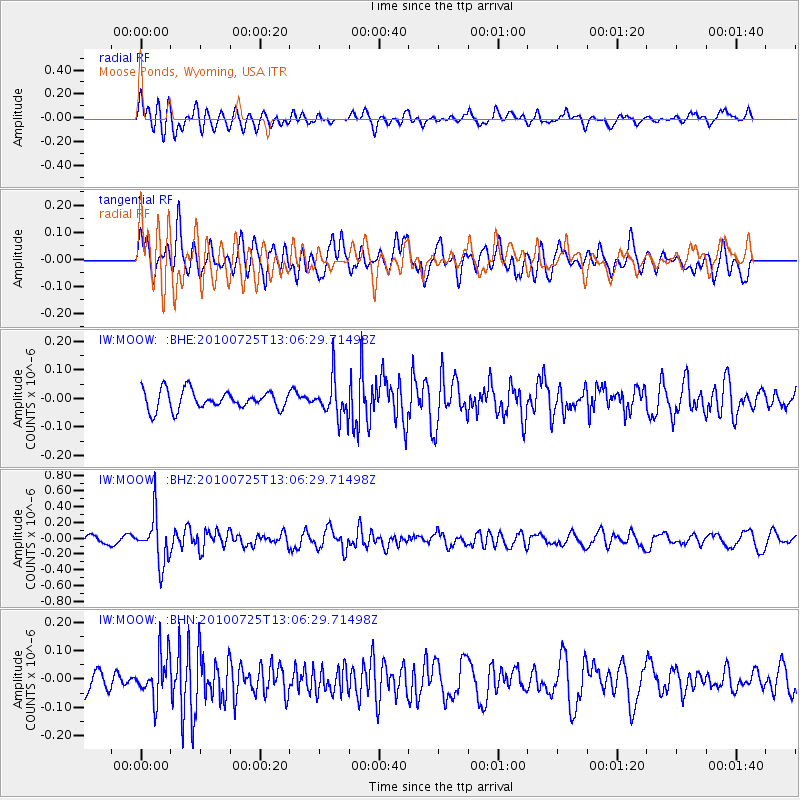
Signal To Noise
| Channel | StoN | STA | LTA |
| IW:MOOW: :BHZ:20100725T13:06:29.71498Z | 6.681169 | 2.9767855E-7 | 4.4554863E-8 |
| IW:MOOW: :BHN:20100725T13:06:29.71498Z | 2.5110426 | 7.741457E-8 | 3.0829653E-8 |
| IW:MOOW: :BHE:20100725T13:06:29.71498Z | 2.0023534 | 6.599223E-8 | 3.295733E-8 |
| Arrivals |
| Ps | |
| PpPs | |
| PsPs/PpSs | |


