You are here: Home > Network List > US - United States National Seismic Network Stations List
> Station MSO Missoula, Montana, USA > Earthquake Result Viewer
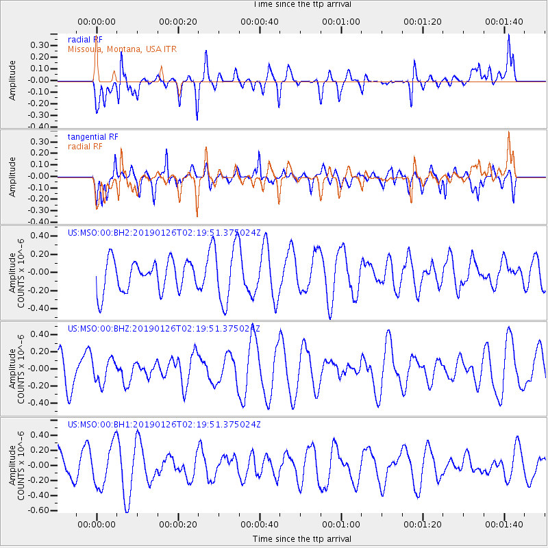
MSO Missoula, Montana, USA - Earthquake Result Viewer
*The percent match for this event was below the threshold and hence no stack was calculated.
| Earthquake location: |
Santa Cruz Islands |
| Earthquake latitude/longitude: |
-10.9/165.9 |
| Earthquake time(UTC): |
2019/01/26 (026) 02:07:23 GMT |
| Earthquake Depth: |
52 km |
| Earthquake Magnitude: |
5.7 Mww |
| Earthquake Catalog/Contributor: |
NEIC PDE/us |
|
| Network: |
US United States National Seismic Network |
| Station: |
MSO Missoula, Montana, USA |
| Lat/Lon: |
46.83 N/113.94 W |
| Elevation: |
1264 m |
|
| Distance: |
91.2 deg |
| Az: |
42.575 deg |
| Baz: |
255.442 deg |
| Ray Param: |
$rayparam |
*The percent match for this event was below the threshold and hence was not used in the summary stack. |
|
| Radial Match: |
38.4825 % |
| Radial Bump: |
392 |
| Transverse Match: |
51.228188 % |
| Transverse Bump: |
400 |
| SOD ConfigId: |
3276131 |
| Insert Time: |
2019-02-09 02:21:25.712 +0000 |
| GWidth: |
2.5 |
| Max Bumps: |
400 |
| Tol: |
0.001 |
|
Signal To Noise
| Channel | StoN | STA | LTA |
| US:MSO:00:BHZ:20190126T02:19:51.375024Z | 0.8864768 | 1.381726E-7 | 1.5586713E-7 |
| US:MSO:00:BH1:20190126T02:19:51.375024Z | 1.5776026 | 2.84448E-7 | 1.8030396E-7 |
| US:MSO:00:BH2:20190126T02:19:51.375024Z | 1.91829 | 3.2172915E-7 | 1.6771664E-7 |
| Arrivals |
| Ps | |
| PpPs | |
| PsPs/PpSs | |


