You are here: Home > Network List > TA - USArray Transportable Network (new EarthScope stations) Stations List
> Station MDND Maddock, ND, USA > Earthquake Result Viewer
MDND Maddock, ND, USA - Earthquake Result Viewer
*The percent match for this event was below the threshold and hence no stack was calculated.
| Earthquake location: |
Kuril Islands |
| Earthquake latitude/longitude: |
49.7/154.6 |
| Earthquake time(UTC): |
2010/07/25 (206) 12:57:01 GMT |
| Earthquake Depth: |
130 km |
| Earthquake Magnitude: |
5.7 MB, 5.6 MW, 5.6 MW |
| Earthquake Catalog/Contributor: |
WHDF/NEIC |
|
| Network: |
TA USArray Transportable Network (new EarthScope stations) |
| Station: |
MDND Maddock, ND, USA |
| Lat/Lon: |
47.85 N/99.60 W |
| Elevation: |
479 m |
|
| Distance: |
63.7 deg |
| Az: |
46.321 deg |
| Baz: |
315.803 deg |
| Ray Param: |
$rayparam |
*The percent match for this event was below the threshold and hence was not used in the summary stack. |
|
| Radial Match: |
64.97549 % |
| Radial Bump: |
400 |
| Transverse Match: |
64.10836 % |
| Transverse Bump: |
400 |
| SOD ConfigId: |
319893 |
| Insert Time: |
2011-01-05 11:50:01.021 +0000 |
| GWidth: |
2.5 |
| Max Bumps: |
400 |
| Tol: |
0.001 |
|
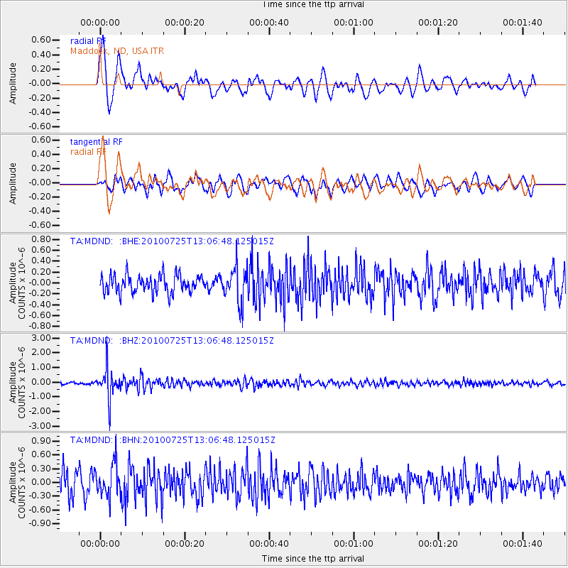
Signal To Noise
| Channel | StoN | STA | LTA |
| TA:MDND: :BHZ:20100725T13:06:48.125015Z | 11.798236 | 1.022384E-6 | 8.665567E-8 |
| TA:MDND: :BHN:20100725T13:06:48.125015Z | 0.9703628 | 3.570018E-7 | 3.6790547E-7 |
| TA:MDND: :BHE:20100725T13:06:48.125015Z | 2.0740168 | 3.343672E-7 | 1.612172E-7 |
| Arrivals |
| Ps | |
| PpPs | |
| PsPs/PpSs | |


