You are here: Home > Network List > TA - USArray Transportable Network (new EarthScope stations) Stations List
> Station F22A Rosebud, MT, USA > Earthquake Result Viewer
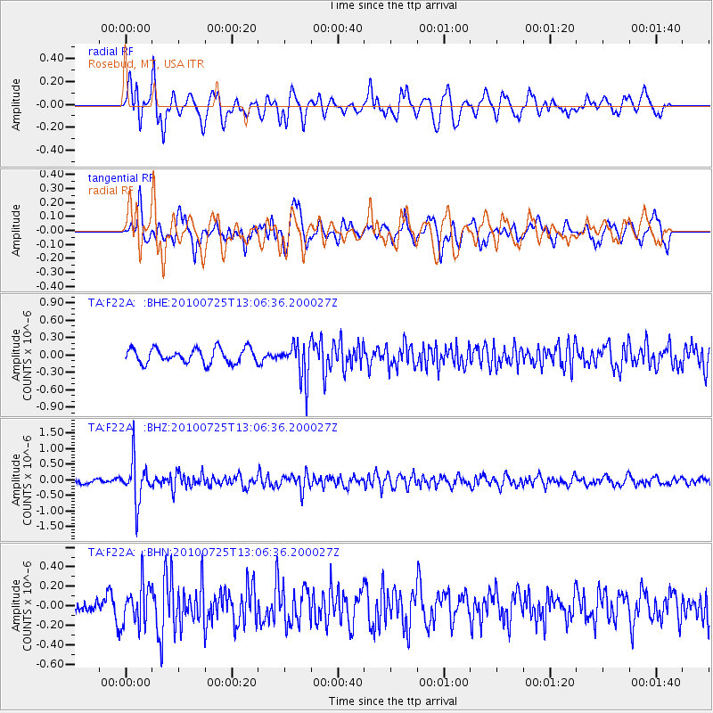
F22A Rosebud, MT, USA - Earthquake Result Viewer
*The percent match for this event was below the threshold and hence no stack was calculated.
| Earthquake location: |
Kuril Islands |
| Earthquake latitude/longitude: |
49.7/154.6 |
| Earthquake time(UTC): |
2010/07/25 (206) 12:57:01 GMT |
| Earthquake Depth: |
130 km |
| Earthquake Magnitude: |
5.7 MB, 5.6 MW, 5.6 MW |
| Earthquake Catalog/Contributor: |
WHDF/NEIC |
|
| Network: |
TA USArray Transportable Network (new EarthScope stations) |
| Station: |
F22A Rosebud, MT, USA |
| Lat/Lon: |
45.78 N/106.26 W |
| Elevation: |
882 m |
|
| Distance: |
61.9 deg |
| Az: |
51.583 deg |
| Baz: |
313.372 deg |
| Ray Param: |
$rayparam |
*The percent match for this event was below the threshold and hence was not used in the summary stack. |
|
| Radial Match: |
68.60664 % |
| Radial Bump: |
400 |
| Transverse Match: |
67.864655 % |
| Transverse Bump: |
400 |
| SOD ConfigId: |
319893 |
| Insert Time: |
2011-01-05 11:51:16.644 +0000 |
| GWidth: |
2.5 |
| Max Bumps: |
400 |
| Tol: |
0.001 |
|
Signal To Noise
| Channel | StoN | STA | LTA |
| TA:F22A: :BHZ:20100725T13:06:36.200027Z | 10.466827 | 6.7493477E-7 | 6.4483224E-8 |
| TA:F22A: :BHN:20100725T13:06:36.200027Z | 2.116636 | 2.0597624E-7 | 9.731301E-8 |
| TA:F22A: :BHE:20100725T13:06:36.200027Z | 2.5091798 | 3.1813482E-7 | 1.2678836E-7 |
| Arrivals |
| Ps | |
| PpPs | |
| PsPs/PpSs | |


