You are here: Home > Network List > US - United States National Seismic Network Stations List
> Station HAWA Hanford, Washington, USA > Earthquake Result Viewer
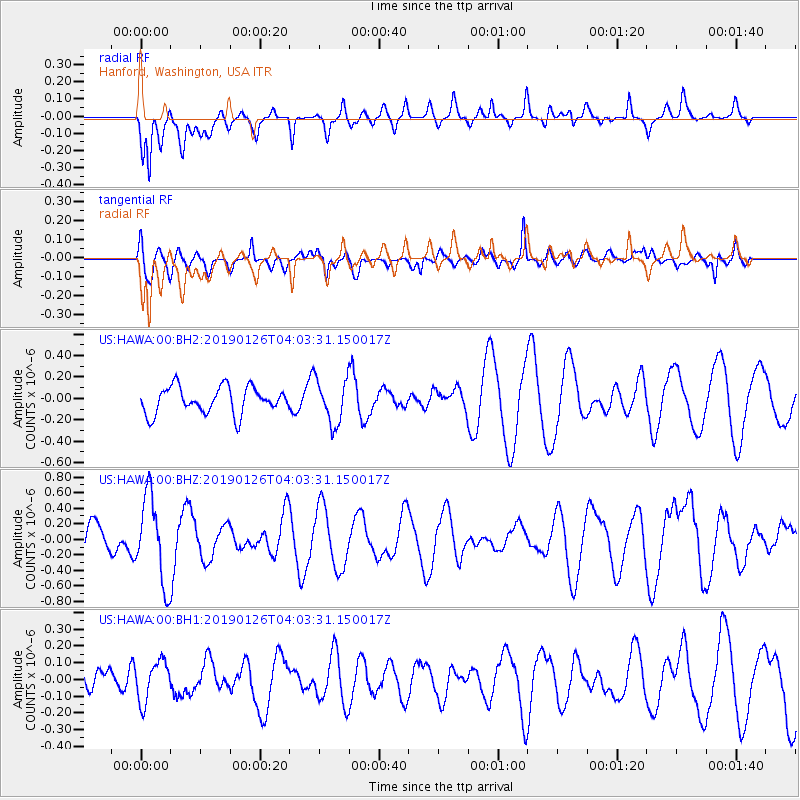
HAWA Hanford, Washington, USA - Earthquake Result Viewer
*The percent match for this event was below the threshold and hence no stack was calculated.
| Earthquake location: |
Solomon Islands |
| Earthquake latitude/longitude: |
-7.0/156.3 |
| Earthquake time(UTC): |
2019/01/26 (026) 03:51:38 GMT |
| Earthquake Depth: |
358 km |
| Earthquake Magnitude: |
6.2 Mww |
| Earthquake Catalog/Contributor: |
NEIC PDE/us |
|
| Network: |
US United States National Seismic Network |
| Station: |
HAWA Hanford, Washington, USA |
| Lat/Lon: |
46.39 N/119.53 W |
| Elevation: |
364 m |
|
| Distance: |
91.0 deg |
| Az: |
43.525 deg |
| Baz: |
260.984 deg |
| Ray Param: |
$rayparam |
*The percent match for this event was below the threshold and hence was not used in the summary stack. |
|
| Radial Match: |
60.81982 % |
| Radial Bump: |
400 |
| Transverse Match: |
60.334084 % |
| Transverse Bump: |
400 |
| SOD ConfigId: |
3276131 |
| Insert Time: |
2019-02-09 04:08:20.251 +0000 |
| GWidth: |
2.5 |
| Max Bumps: |
400 |
| Tol: |
0.001 |
|
Signal To Noise
| Channel | StoN | STA | LTA |
| US:HAWA:00:BHZ:20190126T04:03:31.150017Z | 2.9765363 | 5.5333805E-7 | 1.8589999E-7 |
| US:HAWA:00:BH1:20190126T04:03:31.150017Z | 1.0003772 | 1.2167429E-7 | 1.2162843E-7 |
| US:HAWA:00:BH2:20190126T04:03:31.150017Z | 1.670413 | 2.0602727E-7 | 1.2333912E-7 |
| Arrivals |
| Ps | |
| PpPs | |
| PsPs/PpSs | |


