You are here: Home > Network List > TA - USArray Transportable Network (new EarthScope stations) Stations List
> Station D27A Center, ND, USA > Earthquake Result Viewer
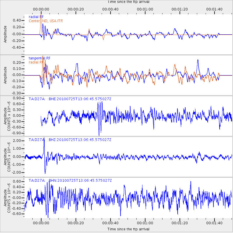
D27A Center, ND, USA - Earthquake Result Viewer
*The percent match for this event was below the threshold and hence no stack was calculated.
| Earthquake location: |
Kuril Islands |
| Earthquake latitude/longitude: |
49.7/154.6 |
| Earthquake time(UTC): |
2010/07/25 (206) 12:57:01 GMT |
| Earthquake Depth: |
130 km |
| Earthquake Magnitude: |
5.7 MB, 5.6 MW, 5.6 MW |
| Earthquake Catalog/Contributor: |
WHDF/NEIC |
|
| Network: |
TA USArray Transportable Network (new EarthScope stations) |
| Station: |
D27A Center, ND, USA |
| Lat/Lon: |
47.11 N/101.53 W |
| Elevation: |
685 m |
|
| Distance: |
63.3 deg |
| Az: |
47.94 deg |
| Baz: |
315.113 deg |
| Ray Param: |
$rayparam |
*The percent match for this event was below the threshold and hence was not used in the summary stack. |
|
| Radial Match: |
52.244545 % |
| Radial Bump: |
400 |
| Transverse Match: |
56.271576 % |
| Transverse Bump: |
400 |
| SOD ConfigId: |
319893 |
| Insert Time: |
2011-01-05 12:02:44.019 +0000 |
| GWidth: |
2.5 |
| Max Bumps: |
400 |
| Tol: |
0.001 |
|
Signal To Noise
| Channel | StoN | STA | LTA |
| TA:D27A: :BHZ:20100725T13:06:45.575027Z | 6.98982 | 9.0442353E-7 | 1.2939152E-7 |
| TA:D27A: :BHN:20100725T13:06:45.575027Z | 1.512162 | 2.911429E-7 | 1.925342E-7 |
| TA:D27A: :BHE:20100725T13:06:45.575027Z | 2.0300577 | 3.83732E-7 | 1.8902519E-7 |
| Arrivals |
| Ps | |
| PpPs | |
| PsPs/PpSs | |


