You are here: Home > Network List > TA - USArray Transportable Network (new EarthScope stations) Stations List
> Station N31A Bailey Ranch, Gibbon, NE, USA > Earthquake Result Viewer
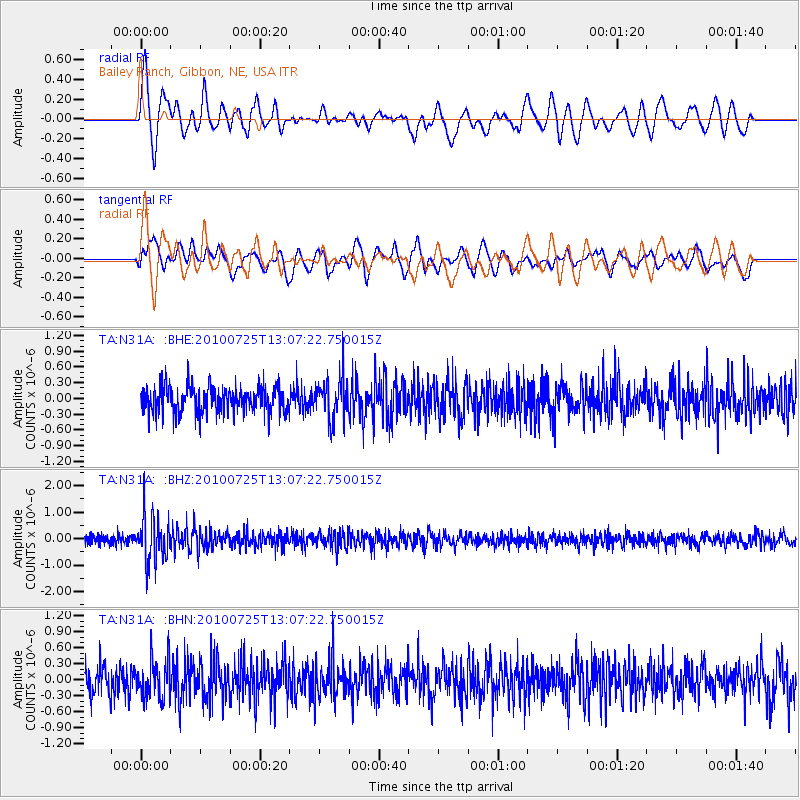
N31A Bailey Ranch, Gibbon, NE, USA - Earthquake Result Viewer
*The percent match for this event was below the threshold and hence no stack was calculated.
| Earthquake location: |
Kuril Islands |
| Earthquake latitude/longitude: |
49.7/154.6 |
| Earthquake time(UTC): |
2010/07/25 (206) 12:57:01 GMT |
| Earthquake Depth: |
130 km |
| Earthquake Magnitude: |
5.7 MB, 5.6 MW, 5.6 MW |
| Earthquake Catalog/Contributor: |
WHDF/NEIC |
|
| Network: |
TA USArray Transportable Network (new EarthScope stations) |
| Station: |
N31A Bailey Ranch, Gibbon, NE, USA |
| Lat/Lon: |
40.82 N/98.95 W |
| Elevation: |
687 m |
|
| Distance: |
69.1 deg |
| Az: |
51.174 deg |
| Baz: |
318.201 deg |
| Ray Param: |
$rayparam |
*The percent match for this event was below the threshold and hence was not used in the summary stack. |
|
| Radial Match: |
63.144264 % |
| Radial Bump: |
400 |
| Transverse Match: |
48.624657 % |
| Transverse Bump: |
400 |
| SOD ConfigId: |
319893 |
| Insert Time: |
2011-01-05 12:06:28.658 +0000 |
| GWidth: |
2.5 |
| Max Bumps: |
400 |
| Tol: |
0.001 |
|
Signal To Noise
| Channel | StoN | STA | LTA |
| TA:N31A: :BHZ:20100725T13:07:22.750015Z | 5.837741 | 8.677001E-7 | 1.4863629E-7 |
| TA:N31A: :BHN:20100725T13:07:22.750015Z | 1.5718974 | 3.6306903E-7 | 2.3097502E-7 |
| TA:N31A: :BHE:20100725T13:07:22.750015Z | 1.5643559 | 3.8359724E-7 | 2.4521097E-7 |
| Arrivals |
| Ps | |
| PpPs | |
| PsPs/PpSs | |


