You are here: Home > Network List > GS - US Geological Survey Networks Stations List
> Station KAN13 Rinehart Farm > Earthquake Result Viewer
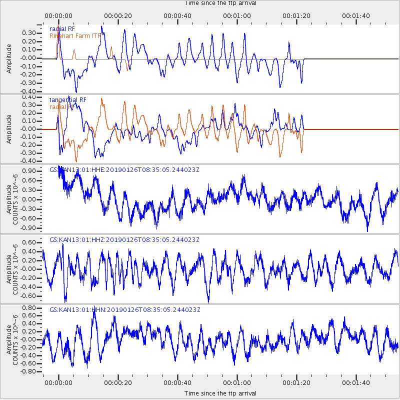
KAN13 Rinehart Farm - Earthquake Result Viewer
*The percent match for this event was below the threshold and hence no stack was calculated.
| Earthquake location: |
Near East Coast Of Honshu, Japan |
| Earthquake latitude/longitude: |
40.3/142.2 |
| Earthquake time(UTC): |
2019/01/26 (026) 08:23:02 GMT |
| Earthquake Depth: |
37 km |
| Earthquake Magnitude: |
5.5 Mww |
| Earthquake Catalog/Contributor: |
NEIC PDE/us |
|
| Network: |
GS US Geological Survey Networks |
| Station: |
KAN13 Rinehart Farm |
| Lat/Lon: |
37.01 N/97.48 W |
| Elevation: |
340 m |
|
| Distance: |
85.5 deg |
| Az: |
43.868 deg |
| Baz: |
318.568 deg |
| Ray Param: |
$rayparam |
*The percent match for this event was below the threshold and hence was not used in the summary stack. |
|
| Radial Match: |
38.176003 % |
| Radial Bump: |
400 |
| Transverse Match: |
33.492058 % |
| Transverse Bump: |
400 |
| SOD ConfigId: |
3276131 |
| Insert Time: |
2019-02-09 08:26:16.746 +0000 |
| GWidth: |
2.5 |
| Max Bumps: |
400 |
| Tol: |
0.001 |
|
Signal To Noise
| Channel | StoN | STA | LTA |
| GS:KAN13:01:HHZ:20190126T08:35:05.244023Z | 1.0026968 | 3.4502838E-7 | 3.441004E-7 |
| GS:KAN13:01:HHN:20190126T08:35:05.244023Z | 0.9295191 | 3.138854E-7 | 3.376858E-7 |
| GS:KAN13:01:HHE:20190126T08:35:05.244023Z | 1.3550277 | 5.8880937E-7 | 4.345368E-7 |
| Arrivals |
| Ps | |
| PpPs | |
| PsPs/PpSs | |


