You are here: Home > Network List > GS - US Geological Survey Networks Stations List
> Station OK051 E0350 and S34600 Roads, Ralston, OK > Earthquake Result Viewer
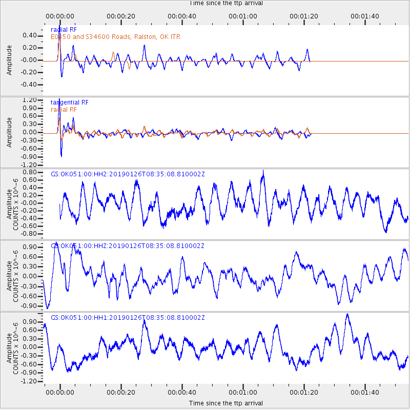
OK051 E0350 and S34600 Roads, Ralston, OK - Earthquake Result Viewer
*The percent match for this event was below the threshold and hence no stack was calculated.
| Earthquake location: |
Near East Coast Of Honshu, Japan |
| Earthquake latitude/longitude: |
40.3/142.2 |
| Earthquake time(UTC): |
2019/01/26 (026) 08:23:02 GMT |
| Earthquake Depth: |
37 km |
| Earthquake Magnitude: |
5.5 Mww |
| Earthquake Catalog/Contributor: |
NEIC PDE/us |
|
| Network: |
GS US Geological Survey Networks |
| Station: |
OK051 E0350 and S34600 Roads, Ralston, OK |
| Lat/Lon: |
36.51 N/96.84 W |
| Elevation: |
263 m |
|
| Distance: |
86.3 deg |
| Az: |
43.814 deg |
| Baz: |
318.947 deg |
| Ray Param: |
$rayparam |
*The percent match for this event was below the threshold and hence was not used in the summary stack. |
|
| Radial Match: |
61.52723 % |
| Radial Bump: |
400 |
| Transverse Match: |
78.00146 % |
| Transverse Bump: |
400 |
| SOD ConfigId: |
3276131 |
| Insert Time: |
2019-02-09 08:26:25.535 +0000 |
| GWidth: |
2.5 |
| Max Bumps: |
400 |
| Tol: |
0.001 |
|
Signal To Noise
| Channel | StoN | STA | LTA |
| GS:OK051:00:HHZ:20190126T08:35:08.810002Z | 1.3221316 | 6.8558285E-7 | 5.185436E-7 |
| GS:OK051:00:HH1:20190126T08:35:08.810002Z | 1.2951581 | 5.973182E-7 | 4.6119328E-7 |
| GS:OK051:00:HH2:20190126T08:35:08.810002Z | 1.3055838 | 3.321712E-7 | 2.544235E-7 |
| Arrivals |
| Ps | |
| PpPs | |
| PsPs/PpSs | |


