You are here: Home > Network List > TA - USArray Transportable Network (new EarthScope stations) Stations List
> Station V35A Meyer Ranch, Chandler, OK, USA > Earthquake Result Viewer
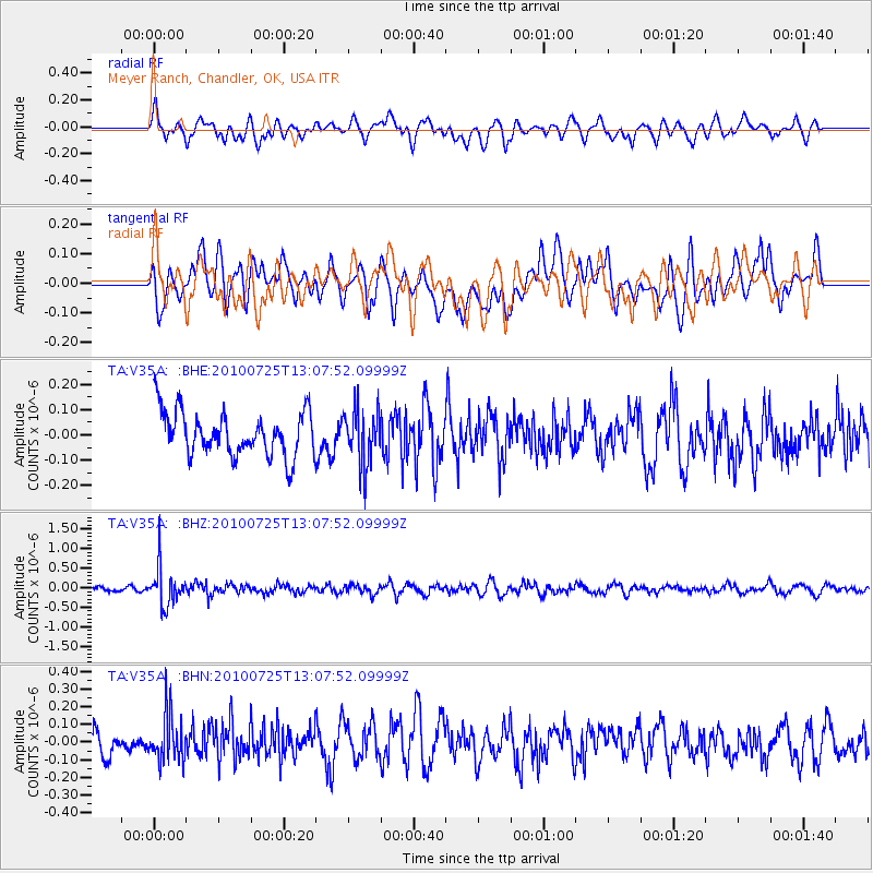
V35A Meyer Ranch, Chandler, OK, USA - Earthquake Result Viewer
*The percent match for this event was below the threshold and hence no stack was calculated.
| Earthquake location: |
Kuril Islands |
| Earthquake latitude/longitude: |
49.7/154.6 |
| Earthquake time(UTC): |
2010/07/25 (206) 12:57:01 GMT |
| Earthquake Depth: |
130 km |
| Earthquake Magnitude: |
5.7 MB, 5.6 MW, 5.6 MW |
| Earthquake Catalog/Contributor: |
WHDF/NEIC |
|
| Network: |
TA USArray Transportable Network (new EarthScope stations) |
| Station: |
V35A Meyer Ranch, Chandler, OK, USA |
| Lat/Lon: |
35.76 N/96.84 W |
| Elevation: |
280 m |
|
| Distance: |
74.1 deg |
| Az: |
53.324 deg |
| Baz: |
320.188 deg |
| Ray Param: |
$rayparam |
*The percent match for this event was below the threshold and hence was not used in the summary stack. |
|
| Radial Match: |
60.001934 % |
| Radial Bump: |
400 |
| Transverse Match: |
47.32072 % |
| Transverse Bump: |
400 |
| SOD ConfigId: |
319893 |
| Insert Time: |
2011-01-05 12:14:34.006 +0000 |
| GWidth: |
2.5 |
| Max Bumps: |
400 |
| Tol: |
0.001 |
|
Signal To Noise
| Channel | StoN | STA | LTA |
| TA:V35A: :BHZ:20100725T13:07:52.09999Z | 7.410632 | 4.8490756E-7 | 6.543404E-8 |
| TA:V35A: :BHN:20100725T13:07:52.09999Z | 1.540643 | 1.3191732E-7 | 8.562484E-8 |
| TA:V35A: :BHE:20100725T13:07:52.09999Z | 1.2784275 | 1.1059953E-7 | 8.6512166E-8 |
| Arrivals |
| Ps | |
| PpPs | |
| PsPs/PpSs | |


