You are here: Home > Network List > US - United States National Seismic Network Stations List
> Station CBKS Cedar Bluff, Kansas, USA > Earthquake Result Viewer
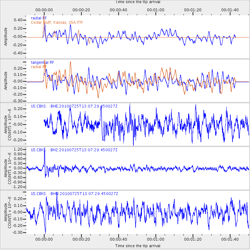
CBKS Cedar Bluff, Kansas, USA - Earthquake Result Viewer
*The percent match for this event was below the threshold and hence no stack was calculated.
| Earthquake location: |
Kuril Islands |
| Earthquake latitude/longitude: |
49.7/154.6 |
| Earthquake time(UTC): |
2010/07/25 (206) 12:57:01 GMT |
| Earthquake Depth: |
130 km |
| Earthquake Magnitude: |
5.7 MB, 5.6 MW, 5.6 MW |
| Earthquake Catalog/Contributor: |
WHDF/NEIC |
|
| Network: |
US United States National Seismic Network |
| Station: |
CBKS Cedar Bluff, Kansas, USA |
| Lat/Lon: |
38.81 N/99.74 W |
| Elevation: |
677 m |
|
| Distance: |
70.2 deg |
| Az: |
53.078 deg |
| Baz: |
318.362 deg |
| Ray Param: |
$rayparam |
*The percent match for this event was below the threshold and hence was not used in the summary stack. |
|
| Radial Match: |
52.87536 % |
| Radial Bump: |
400 |
| Transverse Match: |
57.51551 % |
| Transverse Bump: |
400 |
| SOD ConfigId: |
319893 |
| Insert Time: |
2011-01-05 12:21:35.453 +0000 |
| GWidth: |
2.5 |
| Max Bumps: |
400 |
| Tol: |
0.001 |
|
Signal To Noise
| Channel | StoN | STA | LTA |
| US:CBKS: :BHZ:20100725T13:07:29.450027Z | 5.391845 | 3.535436E-7 | 6.5570056E-8 |
| US:CBKS: :BHN:20100725T13:07:29.450027Z | 1.6962285 | 1.18616946E-7 | 6.992982E-8 |
| US:CBKS: :BHE:20100725T13:07:29.450027Z | 1.4474835 | 1.2045335E-7 | 8.321569E-8 |
| Arrivals |
| Ps | |
| PpPs | |
| PsPs/PpSs | |


