You are here: Home > Network List > US - United States National Seismic Network Stations List
> Station EGMT Eagleton, Montana, USA > Earthquake Result Viewer
EGMT Eagleton, Montana, USA - Earthquake Result Viewer
*The percent match for this event was below the threshold and hence no stack was calculated.
| Earthquake location: |
Kuril Islands |
| Earthquake latitude/longitude: |
49.7/154.6 |
| Earthquake time(UTC): |
2010/07/25 (206) 12:57:01 GMT |
| Earthquake Depth: |
130 km |
| Earthquake Magnitude: |
5.7 MB, 5.6 MW, 5.6 MW |
| Earthquake Catalog/Contributor: |
WHDF/NEIC |
|
| Network: |
US United States National Seismic Network |
| Station: |
EGMT Eagleton, Montana, USA |
| Lat/Lon: |
48.02 N/109.75 W |
| Elevation: |
1055 m |
|
| Distance: |
58.6 deg |
| Az: |
51.515 deg |
| Baz: |
310.791 deg |
| Ray Param: |
$rayparam |
*The percent match for this event was below the threshold and hence was not used in the summary stack. |
|
| Radial Match: |
55.393494 % |
| Radial Bump: |
400 |
| Transverse Match: |
57.640175 % |
| Transverse Bump: |
400 |
| SOD ConfigId: |
319893 |
| Insert Time: |
2011-01-05 12:23:50.262 +0000 |
| GWidth: |
2.5 |
| Max Bumps: |
400 |
| Tol: |
0.001 |
|
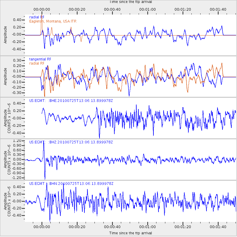
Signal To Noise
| Channel | StoN | STA | LTA |
| US:EGMT: :BHZ:20100725T13:06:13.899978Z | 8.257914 | 4.516333E-7 | 5.469097E-8 |
| US:EGMT: :BHN:20100725T13:06:13.899978Z | 1.9792788 | 2.4262707E-7 | 1.2258357E-7 |
| US:EGMT: :BHE:20100725T13:06:13.899978Z | 2.162995 | 1.914377E-7 | 8.850584E-8 |
| Arrivals |
| Ps | |
| PpPs | |
| PsPs/PpSs | |


