You are here: Home > Network List > US - United States National Seismic Network Stations List
> Station AMTX Amarillo, Texas, USA > Earthquake Result Viewer
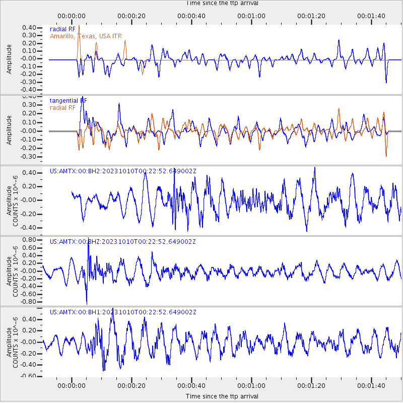
AMTX Amarillo, Texas, USA - Earthquake Result Viewer
*The percent match for this event was below the threshold and hence no stack was calculated.
| Earthquake location: |
Salta Province, Argentina |
| Earthquake latitude/longitude: |
-23.6/-63.7 |
| Earthquake time(UTC): |
2023/10/10 (283) 00:13:15 GMT |
| Earthquake Depth: |
538 km |
| Earthquake Magnitude: |
5.6 Mww |
| Earthquake Catalog/Contributor: |
NEIC PDE/us |
|
| Network: |
US United States National Seismic Network |
| Station: |
AMTX Amarillo, Texas, USA |
| Lat/Lon: |
34.53 N/101.41 W |
| Elevation: |
1010 m |
|
| Distance: |
68.0 deg |
| Az: |
326.972 deg |
| Baz: |
142.729 deg |
| Ray Param: |
$rayparam |
*The percent match for this event was below the threshold and hence was not used in the summary stack. |
|
| Radial Match: |
53.509277 % |
| Radial Bump: |
400 |
| Transverse Match: |
43.89694 % |
| Transverse Bump: |
400 |
| SOD ConfigId: |
31937991 |
| Insert Time: |
2023-10-24 00:35:46.016 +0000 |
| GWidth: |
2.5 |
| Max Bumps: |
400 |
| Tol: |
0.001 |
|
Signal To Noise
| Channel | StoN | STA | LTA |
| US:AMTX:00:BHZ:20231010T00:22:52.649002Z | 2.5247357 | 2.3593506E-7 | 9.344941E-8 |
| US:AMTX:00:BH1:20231010T00:22:52.649002Z | 1.2116994 | 1.0022743E-7 | 8.271642E-8 |
| US:AMTX:00:BH2:20231010T00:22:52.649002Z | 1.5056658 | 1.6786761E-7 | 1.1149062E-7 |
| Arrivals |
| Ps | |
| PpPs | |
| PsPs/PpSs | |


