You are here: Home > Network List > UW - Pacific Northwest Regional Seismic Network Stations List
> Station PASS Maple Falls, WA, USA > Earthquake Result Viewer
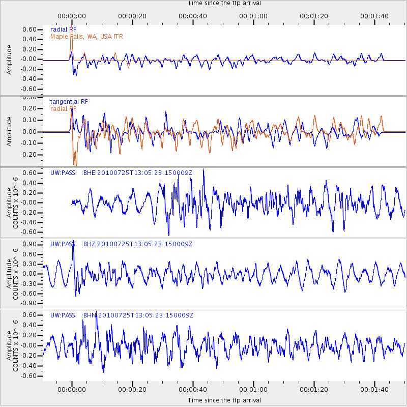
PASS Maple Falls, WA, USA - Earthquake Result Viewer
*The percent match for this event was below the threshold and hence no stack was calculated.
| Earthquake location: |
Kuril Islands |
| Earthquake latitude/longitude: |
49.7/154.6 |
| Earthquake time(UTC): |
2010/07/25 (206) 12:57:01 GMT |
| Earthquake Depth: |
130 km |
| Earthquake Magnitude: |
5.7 MB, 5.6 MW, 5.6 MW |
| Earthquake Catalog/Contributor: |
WHDF/NEIC |
|
| Network: |
UW Pacific Northwest Regional Seismic Network |
| Station: |
PASS Maple Falls, WA, USA |
| Lat/Lon: |
49.00 N/122.09 W |
| Elevation: |
174 m |
|
| Distance: |
51.5 deg |
| Az: |
56.681 deg |
| Baz: |
304.532 deg |
| Ray Param: |
$rayparam |
*The percent match for this event was below the threshold and hence was not used in the summary stack. |
|
| Radial Match: |
62.29476 % |
| Radial Bump: |
400 |
| Transverse Match: |
49.791656 % |
| Transverse Bump: |
400 |
| SOD ConfigId: |
319893 |
| Insert Time: |
2011-01-05 12:25:23.489 +0000 |
| GWidth: |
2.5 |
| Max Bumps: |
400 |
| Tol: |
0.001 |
|
Signal To Noise
| Channel | StoN | STA | LTA |
| UW:PASS: :BHZ:20100725T13:05:23.150009Z | 1.646107 | 3.8444153E-7 | 2.3354589E-7 |
| UW:PASS: :BHN:20100725T13:05:23.150009Z | 1.5342271 | 1.896027E-7 | 1.235819E-7 |
| UW:PASS: :BHE:20100725T13:05:23.150009Z | 2.303392 | 2.8882698E-7 | 1.2539203E-7 |
| Arrivals |
| Ps | |
| PpPs | |
| PsPs/PpSs | |


