You are here: Home > Network List > TA - USArray Transportable Network (new EarthScope stations) Stations List
> Station L02D Cave Junction, OR, USA > Earthquake Result Viewer
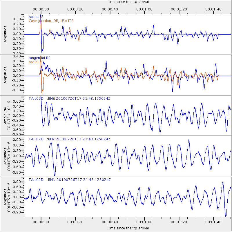
L02D Cave Junction, OR, USA - Earthquake Result Viewer
*The percent match for this event was below the threshold and hence no stack was calculated.
| Earthquake location: |
New Guinea, Papua New Guinea |
| Earthquake latitude/longitude: |
-3.8/141.4 |
| Earthquake time(UTC): |
2010/07/26 (207) 17:08:49 GMT |
| Earthquake Depth: |
35 km |
| Earthquake Magnitude: |
5.6 MB, 5.6 MW, 5.5 MW |
| Earthquake Catalog/Contributor: |
WHDF/NEIC |
|
| Network: |
TA USArray Transportable Network (new EarthScope stations) |
| Station: |
L02D Cave Junction, OR, USA |
| Lat/Lon: |
42.16 N/123.60 W |
| Elevation: |
458 m |
|
| Distance: |
96.3 deg |
| Az: |
48.172 deg |
| Baz: |
270.505 deg |
| Ray Param: |
$rayparam |
*The percent match for this event was below the threshold and hence was not used in the summary stack. |
|
| Radial Match: |
60.580727 % |
| Radial Bump: |
400 |
| Transverse Match: |
56.762238 % |
| Transverse Bump: |
400 |
| SOD ConfigId: |
319893 |
| Insert Time: |
2011-01-05 12:32:20.647 +0000 |
| GWidth: |
2.5 |
| Max Bumps: |
400 |
| Tol: |
0.001 |
|
Signal To Noise
| Channel | StoN | STA | LTA |
| TA:L02D: :BHZ:20100726T17:21:43.125024Z | 1.382448 | 2.9561193E-7 | 2.1383222E-7 |
| TA:L02D: :BHN:20100726T17:21:43.125024Z | 1.0845692 | 3.4999033E-7 | 3.2269983E-7 |
| TA:L02D: :BHE:20100726T17:21:43.125024Z | 0.91705954 | 2.1190871E-7 | 2.310741E-7 |
| Arrivals |
| Ps | |
| PpPs | |
| PsPs/PpSs | |


