You are here: Home > Network List > IW - Intermountain West Stations List
> Station MOOW Moose Ponds, Wyoming, USA > Earthquake Result Viewer
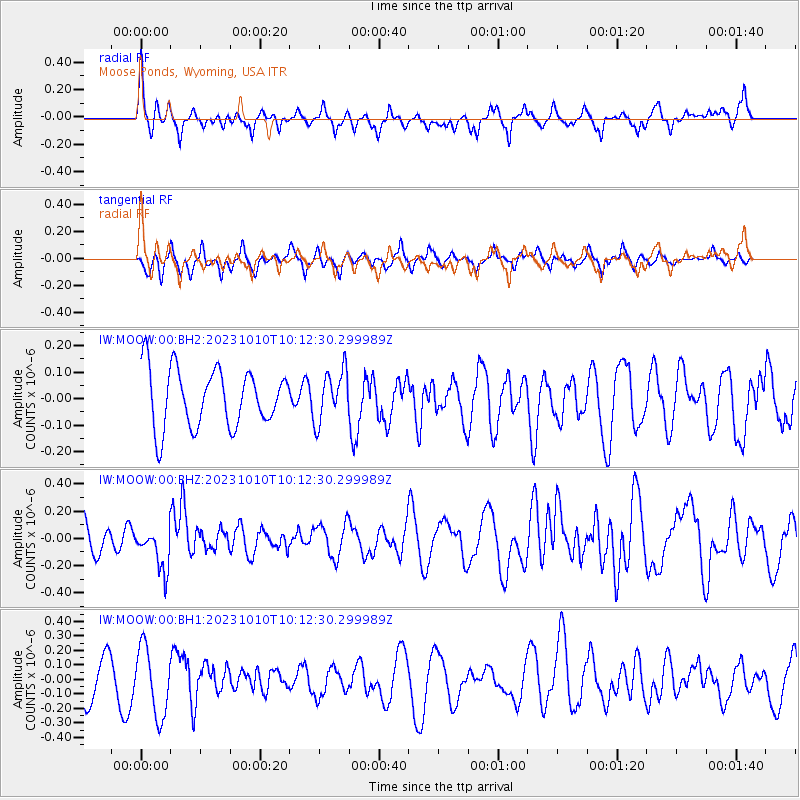
MOOW Moose Ponds, Wyoming, USA - Earthquake Result Viewer
*The percent match for this event was below the threshold and hence no stack was calculated.
| Earthquake location: |
Jujuy Province, Argentina |
| Earthquake latitude/longitude: |
-22.9/-66.2 |
| Earthquake time(UTC): |
2023/10/10 (283) 10:01:31 GMT |
| Earthquake Depth: |
247 km |
| Earthquake Magnitude: |
6.0 Mww |
| Earthquake Catalog/Contributor: |
NEIC PDE/us |
|
| Network: |
IW Intermountain West |
| Station: |
MOOW Moose Ponds, Wyoming, USA |
| Lat/Lon: |
43.75 N/110.74 W |
| Elevation: |
2128 m |
|
| Distance: |
77.9 deg |
| Az: |
328.686 deg |
| Baz: |
138.594 deg |
| Ray Param: |
$rayparam |
*The percent match for this event was below the threshold and hence was not used in the summary stack. |
|
| Radial Match: |
61.27894 % |
| Radial Bump: |
360 |
| Transverse Match: |
53.063694 % |
| Transverse Bump: |
376 |
| SOD ConfigId: |
31937991 |
| Insert Time: |
2023-10-24 10:14:24.222 +0000 |
| GWidth: |
2.5 |
| Max Bumps: |
400 |
| Tol: |
0.001 |
|
Signal To Noise
| Channel | StoN | STA | LTA |
| IW:MOOW:00:BHZ:20231010T10:12:30.299989Z | 1.4461418 | 1.5656312E-7 | 1.08262626E-7 |
| IW:MOOW:00:BH1:20231010T10:12:30.299989Z | 1.9638871 | 2.3520539E-7 | 1.1976523E-7 |
| IW:MOOW:00:BH2:20231010T10:12:30.299989Z | 0.866037 | 9.478248E-8 | 1.0944392E-7 |
| Arrivals |
| Ps | |
| PpPs | |
| PsPs/PpSs | |


