You are here: Home > Network List > CI - Caltech Regional Seismic Network Stations List
> Station LGU LGU, Camarillo, CA, USA > Earthquake Result Viewer
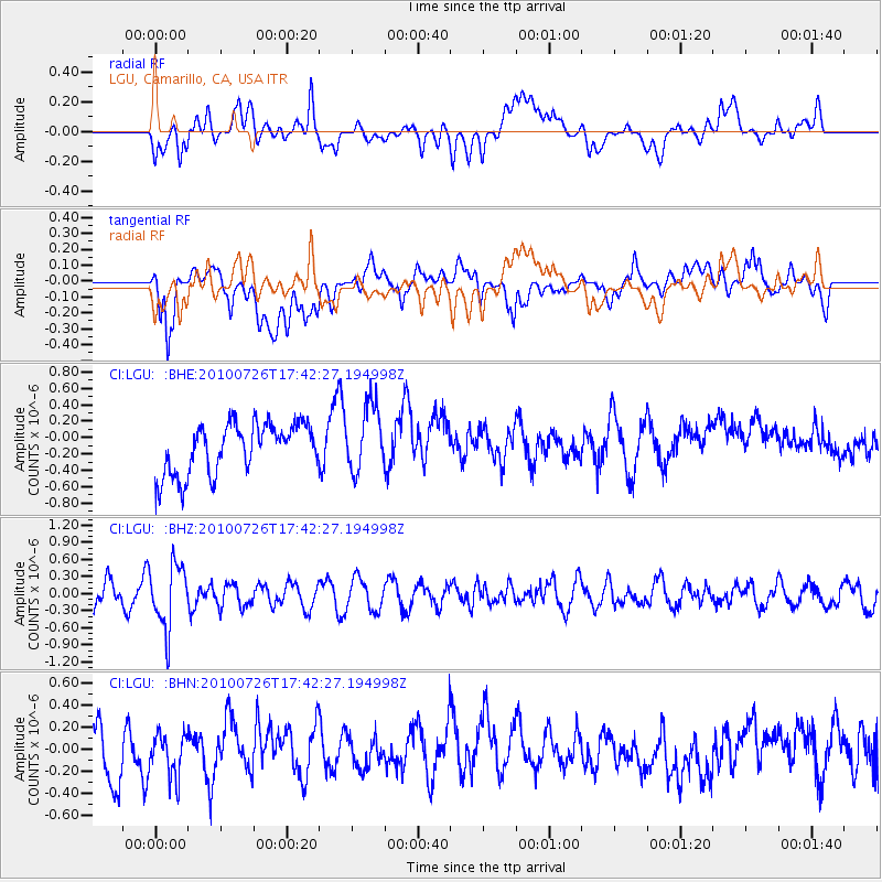
LGU LGU, Camarillo, CA, USA - Earthquake Result Viewer
*The percent match for this event was below the threshold and hence no stack was calculated.
| Earthquake location: |
Salta Province, Argentina |
| Earthquake latitude/longitude: |
-24.1/-66.8 |
| Earthquake time(UTC): |
2010/07/26 (207) 17:31:31 GMT |
| Earthquake Depth: |
193 km |
| Earthquake Magnitude: |
5.6 MW, 5.3 MB, 5.5 MW |
| Earthquake Catalog/Contributor: |
WHDF/NEIC |
|
| Network: |
CI Caltech Regional Seismic Network |
| Station: |
LGU LGU, Camarillo, CA, USA |
| Lat/Lon: |
34.11 N/119.07 W |
| Elevation: |
416 m |
|
| Distance: |
76.2 deg |
| Az: |
317.513 deg |
| Baz: |
131.912 deg |
| Ray Param: |
$rayparam |
*The percent match for this event was below the threshold and hence was not used in the summary stack. |
|
| Radial Match: |
36.64759 % |
| Radial Bump: |
400 |
| Transverse Match: |
65.39369 % |
| Transverse Bump: |
400 |
| SOD ConfigId: |
319893 |
| Insert Time: |
2011-01-05 12:37:03.513 +0000 |
| GWidth: |
2.5 |
| Max Bumps: |
400 |
| Tol: |
0.001 |
|
Signal To Noise
| Channel | StoN | STA | LTA |
| CI:LGU: :BHZ:20100726T17:42:27.194998Z | 2.7640142 | 5.575085E-7 | 2.0170246E-7 |
| CI:LGU: :BHN:20100726T17:42:27.194998Z | 0.6611598 | 2.0842629E-7 | 3.1524343E-7 |
| CI:LGU: :BHE:20100726T17:42:27.194998Z | 1.3272138 | 4.0510744E-7 | 3.052315E-7 |
| Arrivals |
| Ps | |
| PpPs | |
| PsPs/PpSs | |


