You are here: Home > Network List > TA - USArray Transportable Network (new EarthScope stations) Stations List
> Station I20A Worland, WY, USA > Earthquake Result Viewer
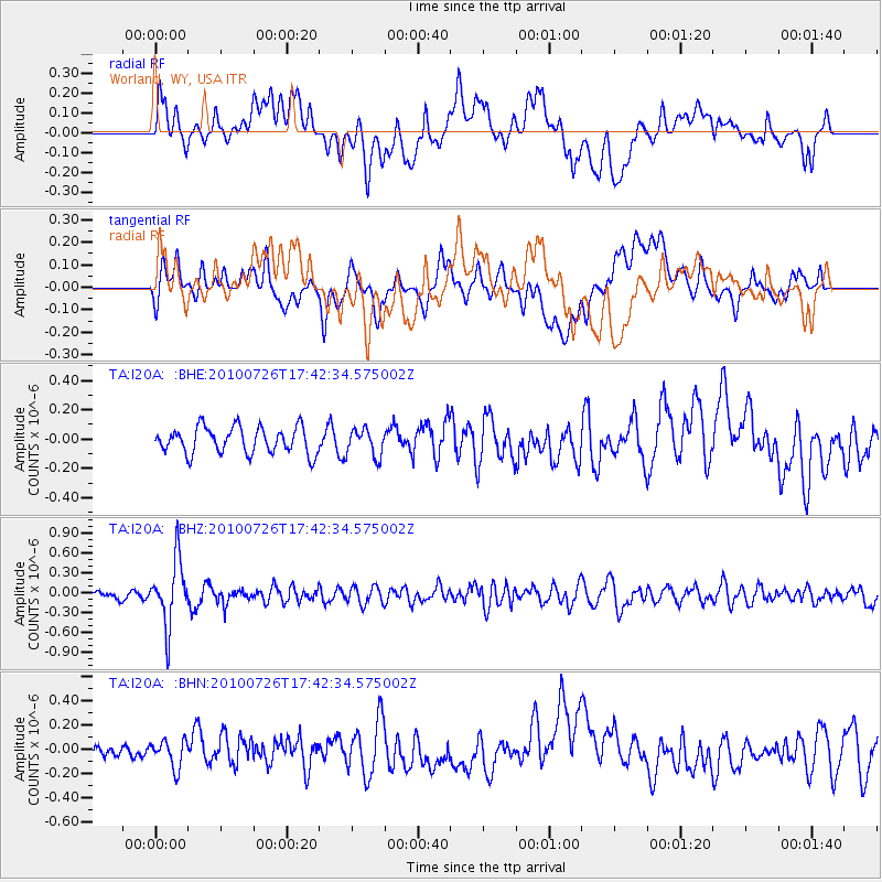
I20A Worland, WY, USA - Earthquake Result Viewer
*The percent match for this event was below the threshold and hence no stack was calculated.
| Earthquake location: |
Salta Province, Argentina |
| Earthquake latitude/longitude: |
-24.1/-66.8 |
| Earthquake time(UTC): |
2010/07/26 (207) 17:31:31 GMT |
| Earthquake Depth: |
193 km |
| Earthquake Magnitude: |
5.6 MW, 5.3 MB, 5.5 MW |
| Earthquake Catalog/Contributor: |
WHDF/NEIC |
|
| Network: |
TA USArray Transportable Network (new EarthScope stations) |
| Station: |
I20A Worland, WY, USA |
| Lat/Lon: |
43.95 N/108.13 W |
| Elevation: |
1342 m |
|
| Distance: |
77.5 deg |
| Az: |
330.776 deg |
| Baz: |
141.833 deg |
| Ray Param: |
$rayparam |
*The percent match for this event was below the threshold and hence was not used in the summary stack. |
|
| Radial Match: |
56.846806 % |
| Radial Bump: |
400 |
| Transverse Match: |
40.561676 % |
| Transverse Bump: |
400 |
| SOD ConfigId: |
319893 |
| Insert Time: |
2011-01-05 12:44:10.882 +0000 |
| GWidth: |
2.5 |
| Max Bumps: |
400 |
| Tol: |
0.001 |
|
Signal To Noise
| Channel | StoN | STA | LTA |
| TA:I20A: :BHZ:20100726T17:42:34.575002Z | 7.052674 | 4.841672E-7 | 6.865015E-8 |
| TA:I20A: :BHN:20100726T17:42:34.575002Z | 1.3608232 | 1.1299768E-7 | 8.303627E-8 |
| TA:I20A: :BHE:20100726T17:42:34.575002Z | 1.0281597 | 9.243854E-8 | 8.990679E-8 |
| Arrivals |
| Ps | |
| PpPs | |
| PsPs/PpSs | |


