You are here: Home > Network List > TA - USArray Transportable Network (new EarthScope stations) Stations List
> Station 228A UT Block 9, Goldsmith, TX, USA > Earthquake Result Viewer
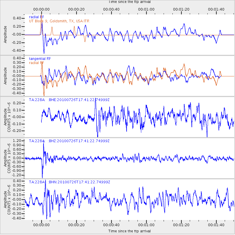
228A UT Block 9, Goldsmith, TX, USA - Earthquake Result Viewer
*The percent match for this event was below the threshold and hence no stack was calculated.
| Earthquake location: |
Salta Province, Argentina |
| Earthquake latitude/longitude: |
-24.1/-66.8 |
| Earthquake time(UTC): |
2010/07/26 (207) 17:31:31 GMT |
| Earthquake Depth: |
193 km |
| Earthquake Magnitude: |
5.6 MW, 5.3 MB, 5.5 MW |
| Earthquake Catalog/Contributor: |
WHDF/NEIC |
|
| Network: |
TA USArray Transportable Network (new EarthScope stations) |
| Station: |
228A UT Block 9, Goldsmith, TX, USA |
| Lat/Lon: |
32.12 N/102.59 W |
| Elevation: |
954 m |
|
| Distance: |
65.5 deg |
| Az: |
326.967 deg |
| Baz: |
144.035 deg |
| Ray Param: |
$rayparam |
*The percent match for this event was below the threshold and hence was not used in the summary stack. |
|
| Radial Match: |
60.143517 % |
| Radial Bump: |
400 |
| Transverse Match: |
52.051384 % |
| Transverse Bump: |
400 |
| SOD ConfigId: |
319893 |
| Insert Time: |
2011-01-05 12:50:35.662 +0000 |
| GWidth: |
2.5 |
| Max Bumps: |
400 |
| Tol: |
0.001 |
|
Signal To Noise
| Channel | StoN | STA | LTA |
| TA:228A: :BHZ:20100726T17:41:22.74999Z | 7.6186395 | 4.3762978E-7 | 5.7441984E-8 |
| TA:228A: :BHN:20100726T17:41:22.74999Z | 2.2099452 | 1.9816005E-7 | 8.966741E-8 |
| TA:228A: :BHE:20100726T17:41:22.74999Z | 2.4727364 | 1.3970065E-7 | 5.649638E-8 |
| Arrivals |
| Ps | |
| PpPs | |
| PsPs/PpSs | |


