You are here: Home > Network List > TA - USArray Transportable Network (new EarthScope stations) Stations List
> Station 332A Millersview, TX, USA > Earthquake Result Viewer
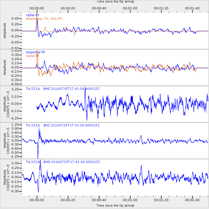
332A Millersview, TX, USA - Earthquake Result Viewer
*The percent match for this event was below the threshold and hence no stack was calculated.
| Earthquake location: |
Salta Province, Argentina |
| Earthquake latitude/longitude: |
-24.1/-66.8 |
| Earthquake time(UTC): |
2010/07/26 (207) 17:31:31 GMT |
| Earthquake Depth: |
193 km |
| Earthquake Magnitude: |
5.6 MW, 5.3 MB, 5.5 MW |
| Earthquake Catalog/Contributor: |
WHDF/NEIC |
|
| Network: |
TA USArray Transportable Network (new EarthScope stations) |
| Station: |
332A Millersview, TX, USA |
| Lat/Lon: |
31.38 N/99.74 W |
| Elevation: |
513 m |
|
| Distance: |
63.5 deg |
| Az: |
328.71 deg |
| Baz: |
146.279 deg |
| Ray Param: |
$rayparam |
*The percent match for this event was below the threshold and hence was not used in the summary stack. |
|
| Radial Match: |
58.19038 % |
| Radial Bump: |
400 |
| Transverse Match: |
61.542892 % |
| Transverse Bump: |
400 |
| SOD ConfigId: |
319893 |
| Insert Time: |
2011-01-05 12:51:55.374 +0000 |
| GWidth: |
2.5 |
| Max Bumps: |
400 |
| Tol: |
0.001 |
|
Signal To Noise
| Channel | StoN | STA | LTA |
| TA:332A: :BHZ:20100726T17:41:09.900015Z | 7.5347204 | 3.9325576E-7 | 5.2192483E-8 |
| TA:332A: :BHN:20100726T17:41:09.900015Z | 3.1685913 | 1.5172274E-7 | 4.7883344E-8 |
| TA:332A: :BHE:20100726T17:41:09.900015Z | 1.9957741 | 9.792242E-8 | 4.906488E-8 |
| Arrivals |
| Ps | |
| PpPs | |
| PsPs/PpSs | |


