You are here: Home > Network List > US - United States National Seismic Network Stations List
> Station DUG Dugway, Tooele County, Utah, USA > Earthquake Result Viewer
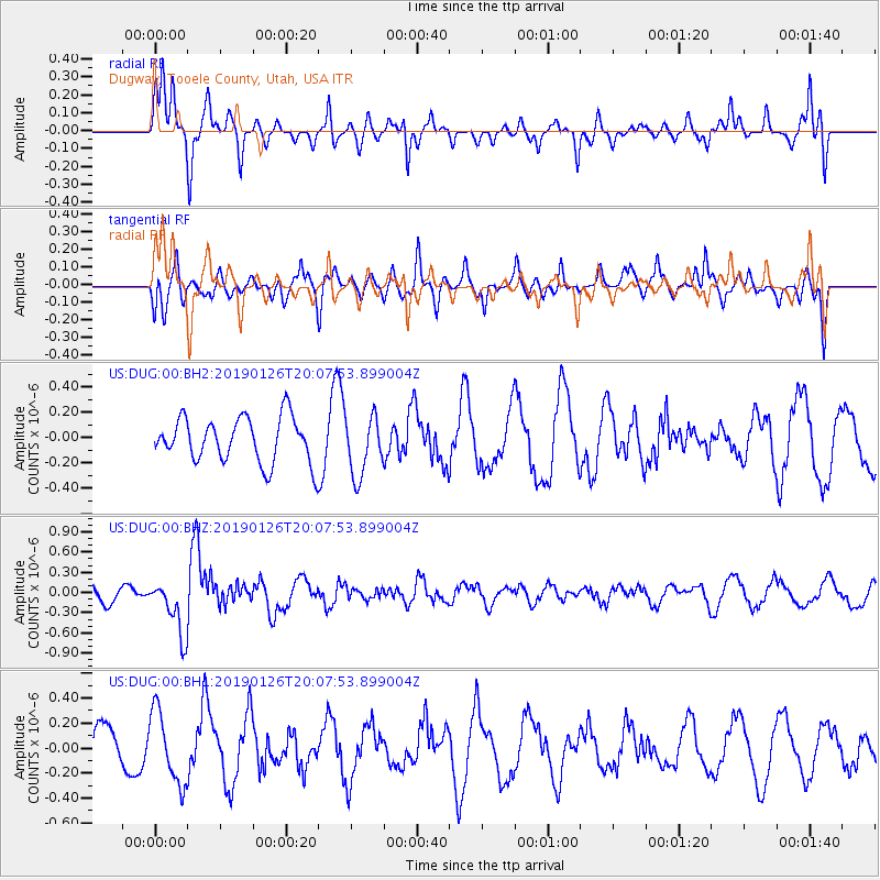
DUG Dugway, Tooele County, Utah, USA - Earthquake Result Viewer
*The percent match for this event was below the threshold and hence no stack was calculated.
| Earthquake location: |
Fiji Islands Region |
| Earthquake latitude/longitude: |
-21.1/-178.9 |
| Earthquake time(UTC): |
2019/01/26 (026) 19:56:42 GMT |
| Earthquake Depth: |
579 km |
| Earthquake Magnitude: |
6.2 Mww |
| Earthquake Catalog/Contributor: |
NEIC PDE/us |
|
| Network: |
US United States National Seismic Network |
| Station: |
DUG Dugway, Tooele County, Utah, USA |
| Lat/Lon: |
40.19 N/112.81 W |
| Elevation: |
1477 m |
|
| Distance: |
86.6 deg |
| Az: |
44.53 deg |
| Baz: |
238.722 deg |
| Ray Param: |
$rayparam |
*The percent match for this event was below the threshold and hence was not used in the summary stack. |
|
| Radial Match: |
57.70451 % |
| Radial Bump: |
232 |
| Transverse Match: |
55.679466 % |
| Transverse Bump: |
290 |
| SOD ConfigId: |
3276131 |
| Insert Time: |
2019-02-09 20:02:26.434 +0000 |
| GWidth: |
2.5 |
| Max Bumps: |
400 |
| Tol: |
0.001 |
|
Signal To Noise
| Channel | StoN | STA | LTA |
| US:DUG:00:BHZ:20190126T20:07:53.899004Z | 3.2662387 | 4.0974822E-7 | 1.2544956E-7 |
| US:DUG:00:BH1:20190126T20:07:53.899004Z | 1.6206446 | 2.8813216E-7 | 1.777886E-7 |
| US:DUG:00:BH2:20190126T20:07:53.899004Z | 1.3316342 | 2.3478174E-7 | 1.7631099E-7 |
| Arrivals |
| Ps | |
| PpPs | |
| PsPs/PpSs | |


