You are here: Home > Network List > TA - USArray Transportable Network (new EarthScope stations) Stations List
> Station 131A Roby, TX, USA > Earthquake Result Viewer
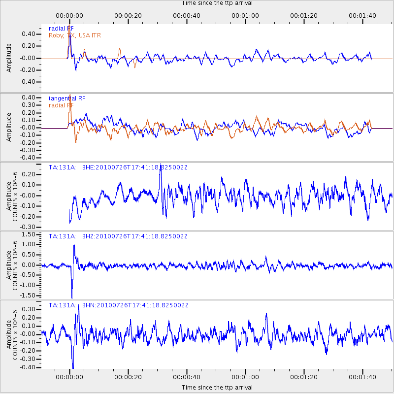
131A Roby, TX, USA - Earthquake Result Viewer
*The percent match for this event was below the threshold and hence no stack was calculated.
| Earthquake location: |
Salta Province, Argentina |
| Earthquake latitude/longitude: |
-24.1/-66.8 |
| Earthquake time(UTC): |
2010/07/26 (207) 17:31:31 GMT |
| Earthquake Depth: |
193 km |
| Earthquake Magnitude: |
5.6 MW, 5.3 MB, 5.5 MW |
| Earthquake Catalog/Contributor: |
WHDF/NEIC |
|
| Network: |
TA USArray Transportable Network (new EarthScope stations) |
| Station: |
131A Roby, TX, USA |
| Lat/Lon: |
32.67 N/100.39 W |
| Elevation: |
622 m |
|
| Distance: |
64.9 deg |
| Az: |
328.999 deg |
| Baz: |
146.064 deg |
| Ray Param: |
$rayparam |
*The percent match for this event was below the threshold and hence was not used in the summary stack. |
|
| Radial Match: |
63.846916 % |
| Radial Bump: |
400 |
| Transverse Match: |
44.71302 % |
| Transverse Bump: |
400 |
| SOD ConfigId: |
319893 |
| Insert Time: |
2011-01-05 12:52:33.594 +0000 |
| GWidth: |
2.5 |
| Max Bumps: |
400 |
| Tol: |
0.001 |
|
Signal To Noise
| Channel | StoN | STA | LTA |
| TA:131A: :BHZ:20100726T17:41:18.825002Z | 6.495816 | 4.6748423E-7 | 7.196697E-8 |
| TA:131A: :BHN:20100726T17:41:18.825002Z | 3.2480717 | 1.7163812E-7 | 5.284308E-8 |
| TA:131A: :BHE:20100726T17:41:18.825002Z | 1.6421818 | 1.2573844E-7 | 7.656792E-8 |
| Arrivals |
| Ps | |
| PpPs | |
| PsPs/PpSs | |


