You are here: Home > Network List > TA - USArray Transportable Network (new EarthScope stations) Stations List
> Station P31A Stockton, KS, USA > Earthquake Result Viewer
P31A Stockton, KS, USA - Earthquake Result Viewer
*The percent match for this event was below the threshold and hence no stack was calculated.
| Earthquake location: |
Salta Province, Argentina |
| Earthquake latitude/longitude: |
-24.1/-66.8 |
| Earthquake time(UTC): |
2010/07/26 (207) 17:31:31 GMT |
| Earthquake Depth: |
193 km |
| Earthquake Magnitude: |
5.6 MW, 5.3 MB, 5.5 MW |
| Earthquake Catalog/Contributor: |
WHDF/NEIC |
|
| Network: |
TA USArray Transportable Network (new EarthScope stations) |
| Station: |
P31A Stockton, KS, USA |
| Lat/Lon: |
39.52 N/99.38 W |
| Elevation: |
665 m |
|
| Distance: |
70.2 deg |
| Az: |
333.742 deg |
| Baz: |
148.473 deg |
| Ray Param: |
$rayparam |
*The percent match for this event was below the threshold and hence was not used in the summary stack. |
|
| Radial Match: |
72.11172 % |
| Radial Bump: |
400 |
| Transverse Match: |
67.27435 % |
| Transverse Bump: |
400 |
| SOD ConfigId: |
319893 |
| Insert Time: |
2011-01-05 12:54:59.036 +0000 |
| GWidth: |
2.5 |
| Max Bumps: |
400 |
| Tol: |
0.001 |
|
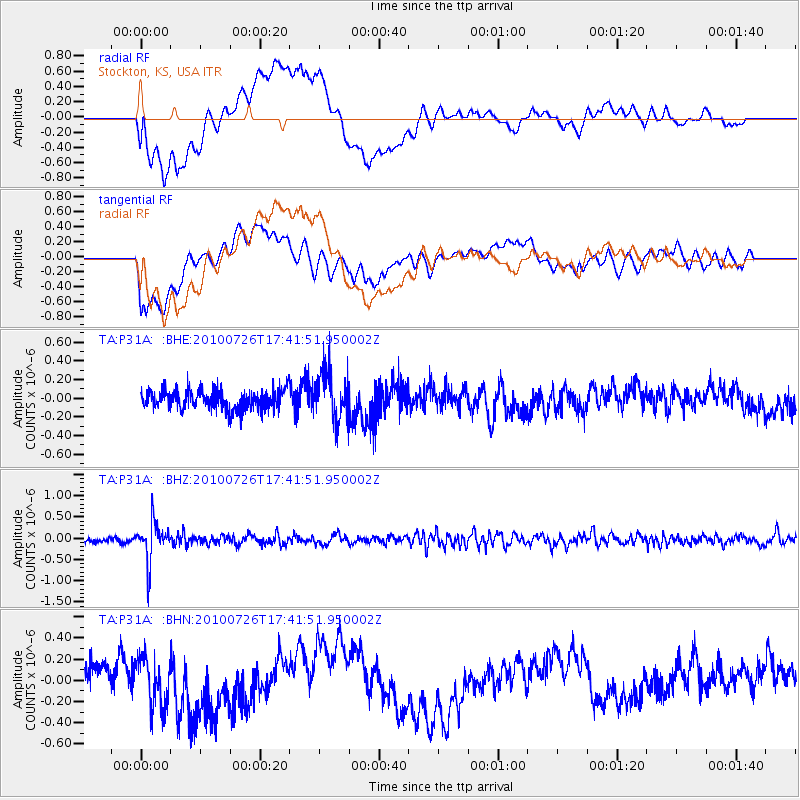
Signal To Noise
| Channel | StoN | STA | LTA |
| TA:P31A: :BHZ:20100726T17:41:51.950002Z | 7.054587 | 4.5407955E-7 | 6.436657E-8 |
| TA:P31A: :BHN:20100726T17:41:51.950002Z | 2.129115 | 2.3868193E-7 | 1.1210382E-7 |
| TA:P31A: :BHE:20100726T17:41:51.950002Z | 2.5431128 | 2.624951E-7 | 1.0321803E-7 |
| Arrivals |
| Ps | |
| PpPs | |
| PsPs/PpSs | |


