You are here: Home > Network List > US - United States National Seismic Network Stations List
> Station EGMT Eagleton, Montana, USA > Earthquake Result Viewer
EGMT Eagleton, Montana, USA - Earthquake Result Viewer
*The percent match for this event was below the threshold and hence no stack was calculated.
| Earthquake location: |
Northwestern Afghanistan |
| Earthquake latitude/longitude: |
34.6/62.1 |
| Earthquake time(UTC): |
2023/10/11 (284) 00:41:56 GMT |
| Earthquake Depth: |
10 km |
| Earthquake Magnitude: |
6.3 Mww |
| Earthquake Catalog/Contributor: |
NEIC PDE/us |
|
| Network: |
US United States National Seismic Network |
| Station: |
EGMT Eagleton, Montana, USA |
| Lat/Lon: |
48.02 N/109.75 W |
| Elevation: |
1055 m |
|
| Distance: |
97.4 deg |
| Az: |
354.477 deg |
| Baz: |
6.794 deg |
| Ray Param: |
$rayparam |
*The percent match for this event was below the threshold and hence was not used in the summary stack. |
|
| Radial Match: |
68.11674 % |
| Radial Bump: |
400 |
| Transverse Match: |
61.59636 % |
| Transverse Bump: |
400 |
| SOD ConfigId: |
31937991 |
| Insert Time: |
2023-10-25 01:05:19.649 +0000 |
| GWidth: |
2.5 |
| Max Bumps: |
400 |
| Tol: |
0.001 |
|
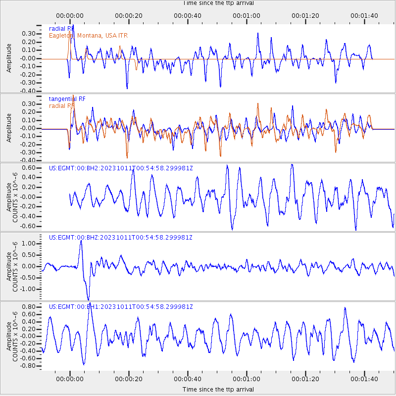
Signal To Noise
| Channel | StoN | STA | LTA |
| US:EGMT:00:BHZ:20231011T00:54:58.299981Z | 2.924778 | 4.3735793E-7 | 1.4953542E-7 |
| US:EGMT:00:BH1:20231011T00:54:58.299981Z | 1.4774467 | 3.2454503E-7 | 2.1966616E-7 |
| US:EGMT:00:BH2:20231011T00:54:58.299981Z | 1.1980311 | 2.1786582E-7 | 1.8185324E-7 |
| Arrivals |
| Ps | |
| PpPs | |
| PsPs/PpSs | |


