You are here: Home > Network List > TA - USArray Transportable Network (new EarthScope stations) Stations List
> Station 234A Clairette, TX, USA > Earthquake Result Viewer
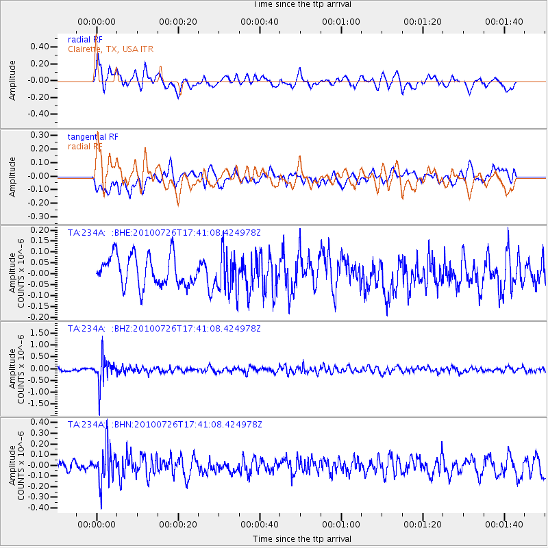
234A Clairette, TX, USA - Earthquake Result Viewer
*The percent match for this event was below the threshold and hence no stack was calculated.
| Earthquake location: |
Salta Province, Argentina |
| Earthquake latitude/longitude: |
-24.1/-66.8 |
| Earthquake time(UTC): |
2010/07/26 (207) 17:31:31 GMT |
| Earthquake Depth: |
193 km |
| Earthquake Magnitude: |
5.6 MW, 5.3 MB, 5.5 MW |
| Earthquake Catalog/Contributor: |
WHDF/NEIC |
|
| Network: |
TA USArray Transportable Network (new EarthScope stations) |
| Station: |
234A Clairette, TX, USA |
| Lat/Lon: |
32.00 N/98.14 W |
| Elevation: |
358 m |
|
| Distance: |
63.3 deg |
| Az: |
330.372 deg |
| Baz: |
147.863 deg |
| Ray Param: |
$rayparam |
*The percent match for this event was below the threshold and hence was not used in the summary stack. |
|
| Radial Match: |
68.569145 % |
| Radial Bump: |
400 |
| Transverse Match: |
48.325413 % |
| Transverse Bump: |
400 |
| SOD ConfigId: |
319893 |
| Insert Time: |
2011-01-05 13:04:45.541 +0000 |
| GWidth: |
2.5 |
| Max Bumps: |
400 |
| Tol: |
0.001 |
|
Signal To Noise
| Channel | StoN | STA | LTA |
| TA:234A: :BHZ:20100726T17:41:08.424978Z | 6.77835 | 5.155542E-7 | 7.605895E-8 |
| TA:234A: :BHN:20100726T17:41:08.424978Z | 3.3614764 | 1.6746347E-7 | 4.981843E-8 |
| TA:234A: :BHE:20100726T17:41:08.424978Z | 1.349441 | 9.3210204E-8 | 6.9073195E-8 |
| Arrivals |
| Ps | |
| PpPs | |
| PsPs/PpSs | |


