You are here: Home > Network List > US - United States National Seismic Network Stations List
> Station AMTX Amarillo, Texas, USA > Earthquake Result Viewer
AMTX Amarillo, Texas, USA - Earthquake Result Viewer
*The percent match for this event was below the threshold and hence no stack was calculated.
| Earthquake location: |
Fox Islands, Aleutian Islands |
| Earthquake latitude/longitude: |
52.6/-171.2 |
| Earthquake time(UTC): |
2023/10/12 (285) 02:41:11 GMT |
| Earthquake Depth: |
125 km |
| Earthquake Magnitude: |
5.5 ml |
| Earthquake Catalog/Contributor: |
NEIC PDE/ak |
|
| Network: |
US United States National Seismic Network |
| Station: |
AMTX Amarillo, Texas, USA |
| Lat/Lon: |
34.53 N/101.41 W |
| Elevation: |
1010 m |
|
| Distance: |
51.6 deg |
| Az: |
81.373 deg |
| Baz: |
313.141 deg |
| Ray Param: |
$rayparam |
*The percent match for this event was below the threshold and hence was not used in the summary stack. |
|
| Radial Match: |
54.685913 % |
| Radial Bump: |
400 |
| Transverse Match: |
53.154842 % |
| Transverse Bump: |
400 |
| SOD ConfigId: |
31937991 |
| Insert Time: |
2023-10-26 03:09:22.660 +0000 |
| GWidth: |
2.5 |
| Max Bumps: |
400 |
| Tol: |
0.001 |
|
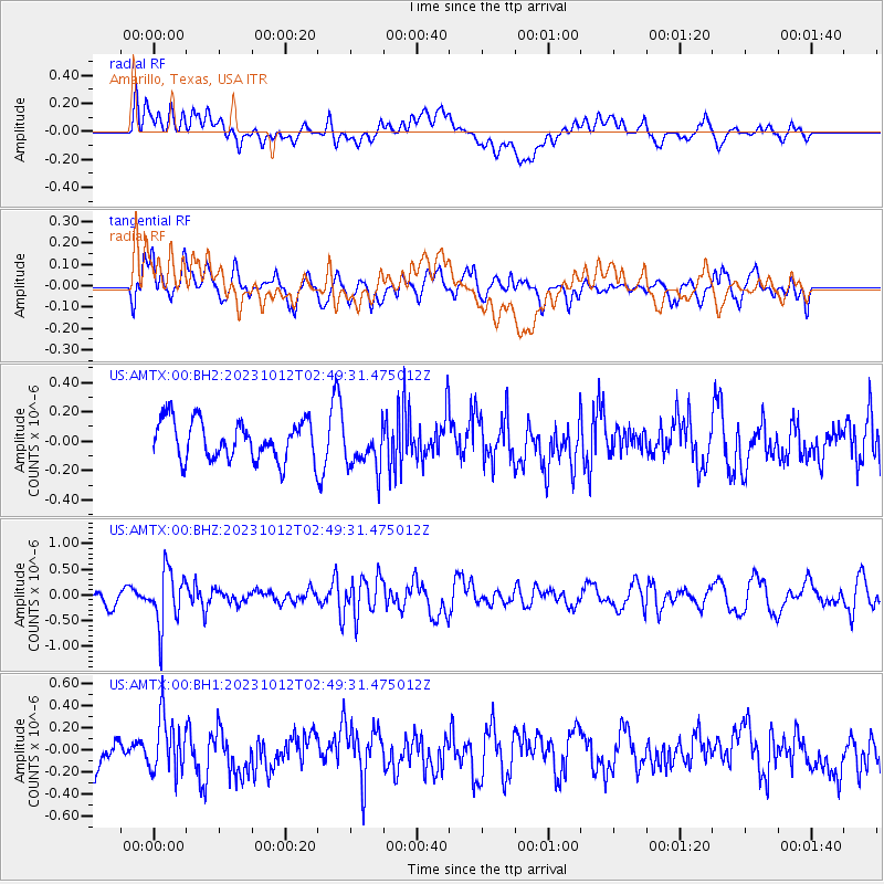
Signal To Noise
| Channel | StoN | STA | LTA |
| US:AMTX:00:BHZ:20231012T02:49:31.475012Z | 3.6162546 | 5.3239495E-7 | 1.4722275E-7 |
| US:AMTX:00:BH1:20231012T02:49:31.475012Z | 2.0738773 | 2.5254062E-7 | 1.2177219E-7 |
| US:AMTX:00:BH2:20231012T02:49:31.475012Z | 1.1923361 | 1.7807862E-7 | 1.4935272E-7 |
| Arrivals |
| Ps | |
| PpPs | |
| PsPs/PpSs | |


