You are here: Home > Network List > US - United States National Seismic Network Stations List
> Station MSO Missoula, Montana, USA > Earthquake Result Viewer
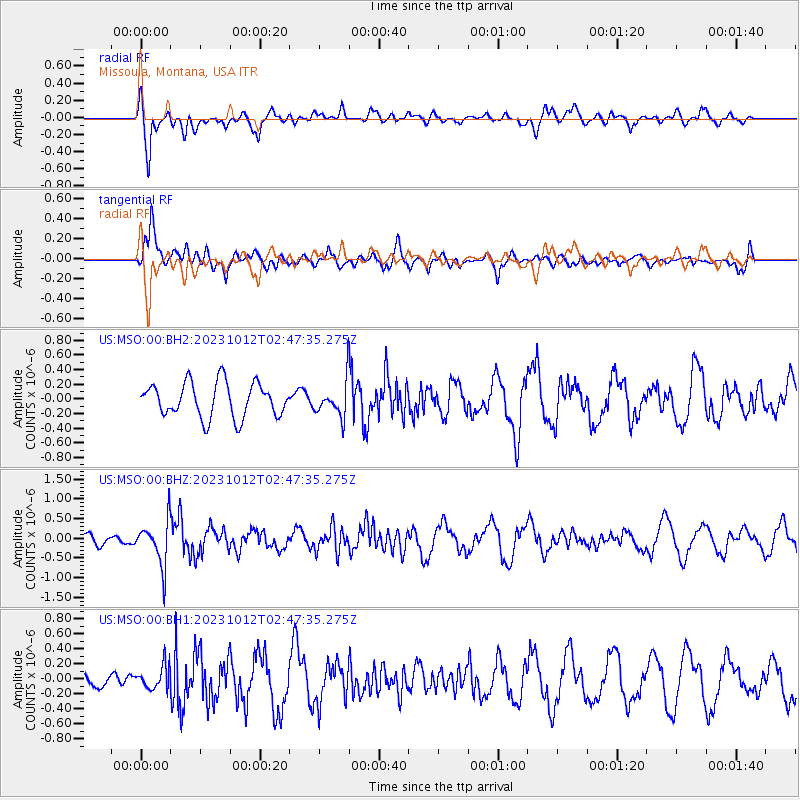
MSO Missoula, Montana, USA - Earthquake Result Viewer
*The percent match for this event was below the threshold and hence no stack was calculated.
| Earthquake location: |
Fox Islands, Aleutian Islands |
| Earthquake latitude/longitude: |
52.6/-171.2 |
| Earthquake time(UTC): |
2023/10/12 (285) 02:41:11 GMT |
| Earthquake Depth: |
125 km |
| Earthquake Magnitude: |
5.5 ml |
| Earthquake Catalog/Contributor: |
NEIC PDE/ak |
|
| Network: |
US United States National Seismic Network |
| Station: |
MSO Missoula, Montana, USA |
| Lat/Lon: |
46.83 N/113.94 W |
| Elevation: |
1264 m |
|
| Distance: |
36.6 deg |
| Az: |
75.584 deg |
| Baz: |
300.743 deg |
| Ray Param: |
$rayparam |
*The percent match for this event was below the threshold and hence was not used in the summary stack. |
|
| Radial Match: |
78.4973 % |
| Radial Bump: |
400 |
| Transverse Match: |
77.54488 % |
| Transverse Bump: |
400 |
| SOD ConfigId: |
31937991 |
| Insert Time: |
2023-10-26 03:10:00.797 +0000 |
| GWidth: |
2.5 |
| Max Bumps: |
400 |
| Tol: |
0.001 |
|
Signal To Noise
| Channel | StoN | STA | LTA |
| US:MSO:00:BHZ:20231012T02:47:35.275Z | 3.096696 | 5.677937E-7 | 1.8335467E-7 |
| US:MSO:00:BH1:20231012T02:47:35.275Z | 0.8795448 | 1.590375E-7 | 1.8081796E-7 |
| US:MSO:00:BH2:20231012T02:47:35.275Z | 0.99092984 | 2.3154386E-7 | 2.3366323E-7 |
| Arrivals |
| Ps | |
| PpPs | |
| PsPs/PpSs | |


