You are here: Home > Network List > US - United States National Seismic Network Stations List
> Station WMOK Wichita Mountains, Oklahoma, USA > Earthquake Result Viewer
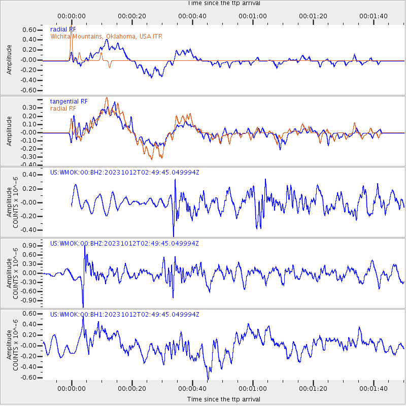
WMOK Wichita Mountains, Oklahoma, USA - Earthquake Result Viewer
*The percent match for this event was below the threshold and hence no stack was calculated.
| Earthquake location: |
Fox Islands, Aleutian Islands |
| Earthquake latitude/longitude: |
52.6/-171.2 |
| Earthquake time(UTC): |
2023/10/12 (285) 02:41:11 GMT |
| Earthquake Depth: |
125 km |
| Earthquake Magnitude: |
5.5 ml |
| Earthquake Catalog/Contributor: |
NEIC PDE/ak |
|
| Network: |
US United States National Seismic Network |
| Station: |
WMOK Wichita Mountains, Oklahoma, USA |
| Lat/Lon: |
34.74 N/98.78 W |
| Elevation: |
486 m |
|
| Distance: |
53.0 deg |
| Az: |
79.306 deg |
| Baz: |
313.364 deg |
| Ray Param: |
$rayparam |
*The percent match for this event was below the threshold and hence was not used in the summary stack. |
|
| Radial Match: |
37.0989 % |
| Radial Bump: |
400 |
| Transverse Match: |
39.627064 % |
| Transverse Bump: |
400 |
| SOD ConfigId: |
31937991 |
| Insert Time: |
2023-10-26 03:10:13.370 +0000 |
| GWidth: |
2.5 |
| Max Bumps: |
400 |
| Tol: |
0.001 |
|
Signal To Noise
| Channel | StoN | STA | LTA |
| US:WMOK:00:BHZ:20231012T02:49:45.049994Z | 2.6933203 | 3.6389963E-7 | 1.3511192E-7 |
| US:WMOK:00:BH1:20231012T02:49:45.049994Z | 2.532248 | 2.2247173E-7 | 8.785543E-8 |
| US:WMOK:00:BH2:20231012T02:49:45.049994Z | 1.6551958 | 1.5360068E-7 | 9.27991E-8 |
| Arrivals |
| Ps | |
| PpPs | |
| PsPs/PpSs | |


