You are here: Home > Network List > TA - USArray Transportable Network (new EarthScope stations) Stations List
> Station N35A Tabor, IA, USA > Earthquake Result Viewer
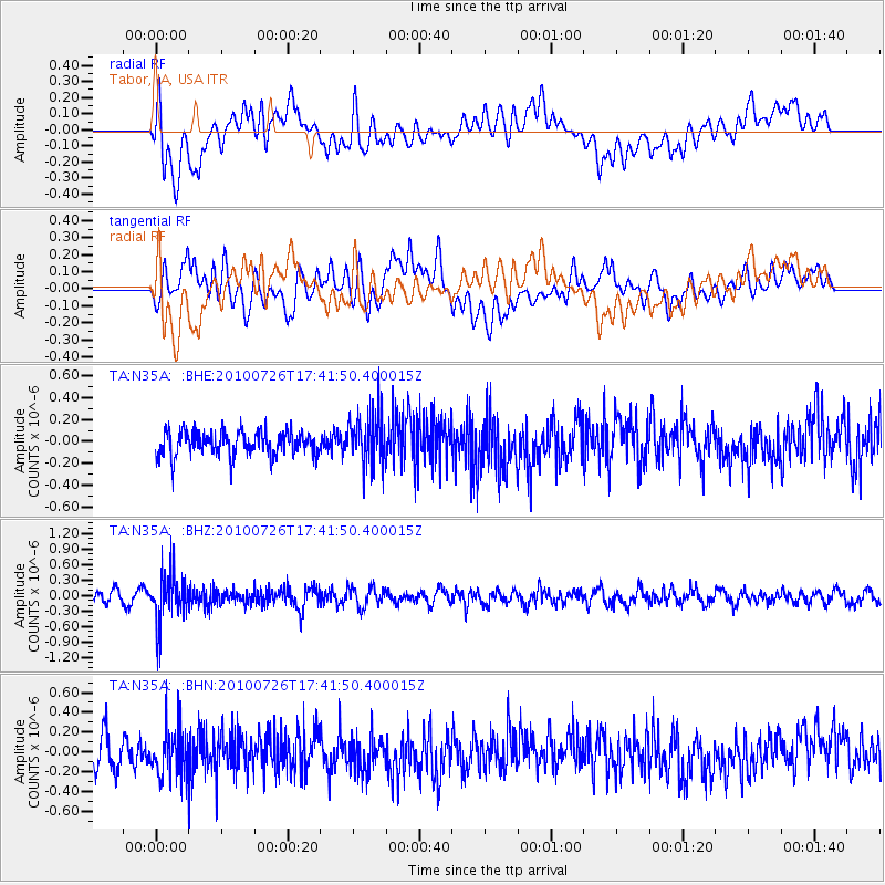
N35A Tabor, IA, USA - Earthquake Result Viewer
*The percent match for this event was below the threshold and hence no stack was calculated.
| Earthquake location: |
Salta Province, Argentina |
| Earthquake latitude/longitude: |
-24.1/-66.8 |
| Earthquake time(UTC): |
2010/07/26 (207) 17:31:31 GMT |
| Earthquake Depth: |
193 km |
| Earthquake Magnitude: |
5.6 MW, 5.3 MB, 5.5 MW |
| Earthquake Catalog/Contributor: |
WHDF/NEIC |
|
| Network: |
TA USArray Transportable Network (new EarthScope stations) |
| Station: |
N35A Tabor, IA, USA |
| Lat/Lon: |
40.86 N/95.64 W |
| Elevation: |
353 m |
|
| Distance: |
69.9 deg |
| Az: |
337.091 deg |
| Baz: |
152.019 deg |
| Ray Param: |
$rayparam |
*The percent match for this event was below the threshold and hence was not used in the summary stack. |
|
| Radial Match: |
55.014297 % |
| Radial Bump: |
400 |
| Transverse Match: |
54.838623 % |
| Transverse Bump: |
400 |
| SOD ConfigId: |
319893 |
| Insert Time: |
2011-01-05 13:09:48.638 +0000 |
| GWidth: |
2.5 |
| Max Bumps: |
400 |
| Tol: |
0.001 |
|
Signal To Noise
| Channel | StoN | STA | LTA |
| TA:N35A: :BHZ:20100726T17:41:50.400015Z | 4.7192883 | 4.6828518E-7 | 9.922792E-8 |
| TA:N35A: :BHN:20100726T17:41:50.400015Z | 1.6554513 | 2.4522603E-7 | 1.4813243E-7 |
| TA:N35A: :BHE:20100726T17:41:50.400015Z | 2.1609147 | 2.3600971E-7 | 1.0921751E-7 |
| Arrivals |
| Ps | |
| PpPs | |
| PsPs/PpSs | |


