You are here: Home > Network List > NE - New England Seismic Network Stations List
> Station EMMW Machias, ME > Earthquake Result Viewer
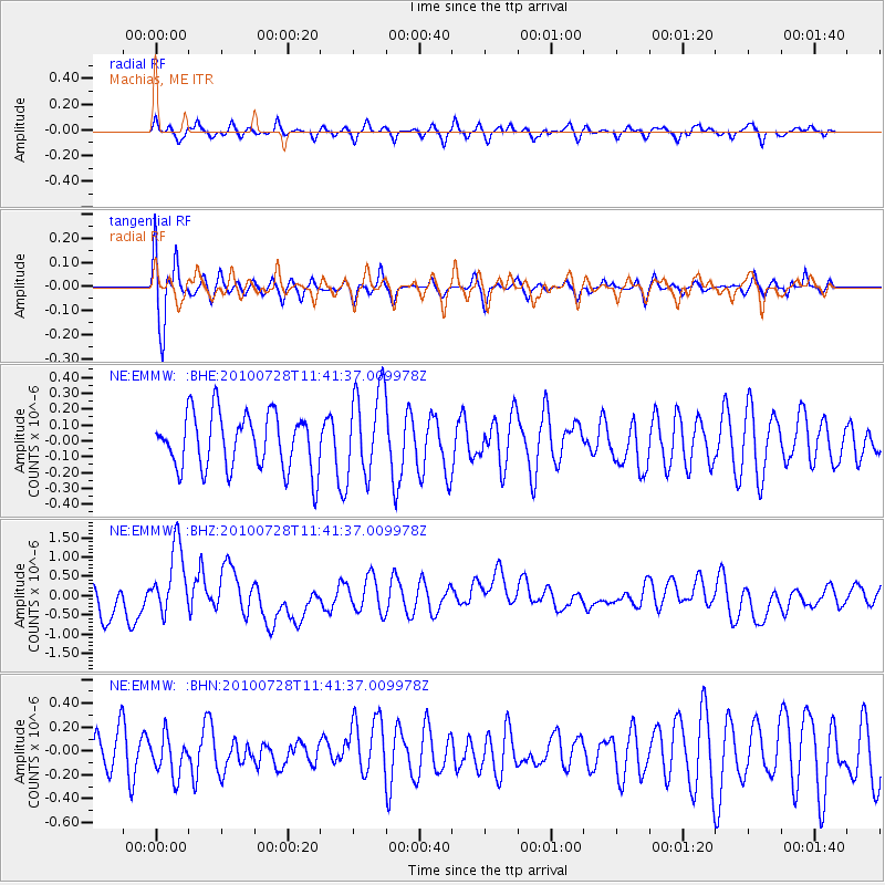
EMMW Machias, ME - Earthquake Result Viewer
*The percent match for this event was below the threshold and hence no stack was calculated.
| Earthquake location: |
Fox Islands, Aleutian Islands |
| Earthquake latitude/longitude: |
52.7/-169.4 |
| Earthquake time(UTC): |
2010/07/28 (209) 11:31:46 GMT |
| Earthquake Depth: |
10 km |
| Earthquake Magnitude: |
5.6 MW, 5.2 MS, 5.2 MB, 5.1 ML |
| Earthquake Catalog/Contributor: |
WHDF/NEIC |
|
| Network: |
NE New England Seismic Network |
| Station: |
EMMW Machias, ME |
| Lat/Lon: |
44.71 N/67.46 W |
| Elevation: |
34 m |
|
| Distance: |
62.2 deg |
| Az: |
52.046 deg |
| Baz: |
317.663 deg |
| Ray Param: |
$rayparam |
*The percent match for this event was below the threshold and hence was not used in the summary stack. |
|
| Radial Match: |
62.623703 % |
| Radial Bump: |
400 |
| Transverse Match: |
79.194954 % |
| Transverse Bump: |
400 |
| SOD ConfigId: |
319893 |
| Insert Time: |
2011-01-05 13:26:54.240 +0000 |
| GWidth: |
2.5 |
| Max Bumps: |
400 |
| Tol: |
0.001 |
|
Signal To Noise
| Channel | StoN | STA | LTA |
| NE:EMMW: :BHZ:20100728T11:41:37.009978Z | 1.5580066 | 9.0015834E-7 | 5.777629E-7 |
| NE:EMMW: :BHN:20100728T11:41:37.009978Z | 1.1793921 | 1.668538E-7 | 1.4147442E-7 |
| NE:EMMW: :BHE:20100728T11:41:37.009978Z | 1.5789359 | 2.765486E-7 | 1.7514873E-7 |
| Arrivals |
| Ps | |
| PpPs | |
| PsPs/PpSs | |


