You are here: Home > Network List > TA - USArray Transportable Network (new EarthScope stations) Stations List
> Station E21A Keefer Ranch, Vananda, MT, USA > Earthquake Result Viewer
E21A Keefer Ranch, Vananda, MT, USA - Earthquake Result Viewer
| Earthquake location: |
Fox Islands, Aleutian Islands |
| Earthquake latitude/longitude: |
52.7/-169.4 |
| Earthquake time(UTC): |
2010/07/28 (209) 11:31:46 GMT |
| Earthquake Depth: |
10 km |
| Earthquake Magnitude: |
5.6 MW, 5.2 MS, 5.2 MB, 5.1 ML |
| Earthquake Catalog/Contributor: |
WHDF/NEIC |
|
| Network: |
TA USArray Transportable Network (new EarthScope stations) |
| Station: |
E21A Keefer Ranch, Vananda, MT, USA |
| Lat/Lon: |
46.54 N/107.08 W |
| Elevation: |
834 m |
|
| Distance: |
39.7 deg |
| Az: |
73.04 deg |
| Baz: |
302.443 deg |
| Ray Param: |
0.074817285 |
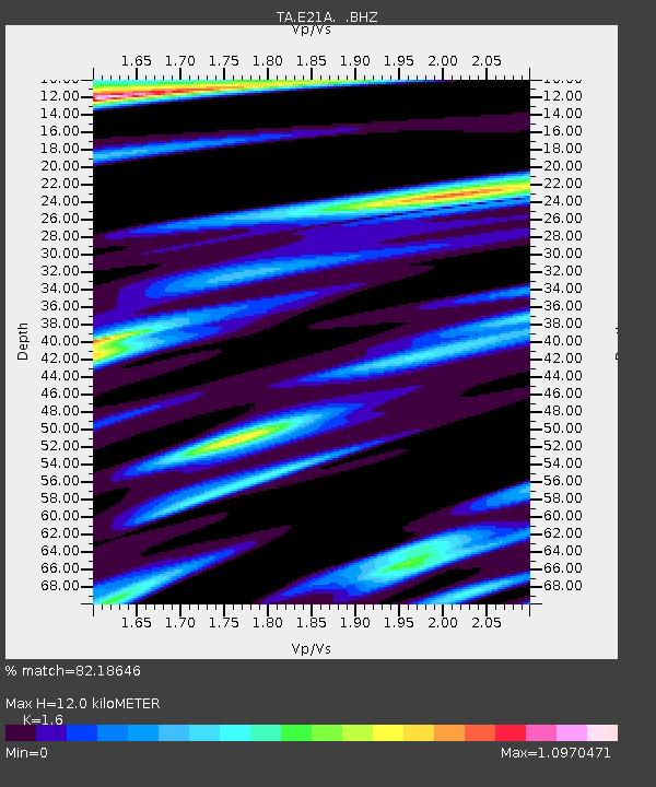
| Estimated Moho Depth: |
12.0 km |
| Estimated Crust Vp/Vs: |
1.60 |
| Assumed Crust Vp: |
6.438 km/s |
| Estimated Crust Vs: |
4.023 km/s |
| Estimated Crust Poisson's Ratio: |
0.18 |
|
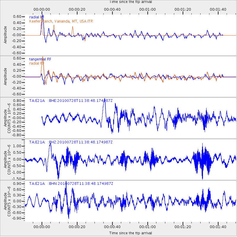
| Radial Match: |
82.18646 % |
| Radial Bump: |
400 |
| Transverse Match: |
63.21718 % |
| Transverse Bump: |
400 |
| SOD ConfigId: |
319893 |
| Insert Time: |
2011-01-05 13:29:31.116 +0000 |
| GWidth: |
2.5 |
| Max Bumps: |
400 |
| Tol: |
0.001 |
|
Signal To Noise
| Channel | StoN | STA | LTA |
| TA:E21A: :BHZ:20100728T11:38:48.174987Z | 7.9669247 | 5.1571243E-7 | 6.473168E-8 |
| TA:E21A: :BHN:20100728T11:38:48.174987Z | 1.3024067 | 1.8468688E-7 | 1.4180432E-7 |
| TA:E21A: :BHE:20100728T11:38:48.174987Z | 1.7943505 | 2.1882029E-7 | 1.2194958E-7 |
| Arrivals |
| Ps | 1.2 SECOND |
| PpPs | 4.5 SECOND |
| PsPs/PpSs | 5.7 SECOND |


